Addresses
Type of place
Flat building
Period
Postwar 1945-1960
Style
Brisbane Regional
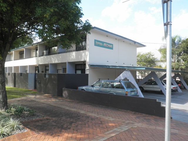

This is an image of the local heritage place known as Flats
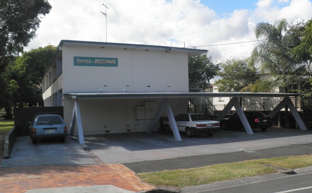
This is an image of the local heritage place known as Flats 1
166 James Street, New Farm
Addresses
Type of place
Flat building
Period
Postwar 1945-1960
Style
Brisbane Regional
This two-storey block of units was built circa 1957 by the owners, Cesare Pradella and Francesco Masinello. The building was reputed to have been designed by the architect Karl Langer.A modernist feature of the masonry building is the use of reinforced concrete supports for the boomerang-shaped carport supports. The units were an early example of postwar architecture that preceded higher-density development in subsequent decades. From the 1960s there was an increasing trend in high-rise apartment blocks such as ‘Roseville’ at 2 Oxlade Drive, also owned by Francesco Masinello.
Lot plan
Key dates
Local Heritage Place Since —
Date of Information —
Construction
Roof: Corrugated iron;Walls: Masonry
People/associations
Cesare Pradella and Francesco Masinello (Builder);Karl Langer (Architect)
Interactive mapping
Lot plan
Key dates
Local Heritage Place Since —
Date of Information —
Construction
Roof: Corrugated iron;Walls: Masonry
People/associations
Cesare Pradella and Francesco Masinello (Builder);Karl Langer (Architect)
Interactive mapping
References
-
Brisbane City Council Properties on the Web
-
Brisbane City Council, 1946 aerial photographs.
-
Brisbane City Council, Sewerage Maps, Detail Plan No 187, 1957
-
Brisbane City Council, building application, Jan 1957
-
Brisbane City Council, New Farm and Teneriffe Hill Heritage and Character Study, Oct 1995, pg 114 [listed incorrectly in survey as 164 James Street]
-
Certificates of Title, Department of Environment and Resource Management
prepared by — Brisbane City Council (page revised March 2023)