Addresses
Type of place
House
Period
Victorian 1860-1890
Style
Queenslander
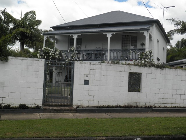

This is an image of the local heritage place known as Residence
26 Tarling Street, Sunnybank Hills
Addresses
Type of place
House
Period
Victorian 1860-1890
Style
Queenslander
This two-storey brick cottage was built around the 1880s for early Scottish settlers, the Rankine family, who established a dairy farm on the property. The property, also known as ‘Rankine’s Flat’ was well-known in the area and occasionally hosted Sunday school picnics. The house is one of the oldest surviving residences in the area and remained in the Rankine family until 1957.
Also known as
Rankine's Flat
Lot plan
L21_RP99650
Key dates
Local Heritage Place Since —
Date of Citation —
Construction
Roof: Corrugated iron;Walls: Masonry
People/associations
Rankine family (Occupant)Criterion for listing
(A) Historical; (B) Rarity; (H) Historical associationInteractive mapping
Also known as
Rankine's Flat
Lot plan
L21_RP99650
Key dates
Local Heritage Place Since —
Date of Citation —
Construction
Roof: Corrugated iron;Walls: Masonry
People/associations
Rankine family (Occupant)Criterion for listing
(A) Historical; (B) Rarity; (H) Historical associationInteractive mapping
History
James Rankine was born in Falkirk, Scotland, in 1844. He, like his forbears, was a gamekeeper on an estate named Callendar near Falkirk, a position believed to have been promised traditionally to the eldest Rankine son of each generation. In the tradition of many Scottish families, the father’s name was handed down to the eldest son. James married Christina Morrison in 1872 in Falkirk, before emigrating to Australia on board the Dacca with their 6 children. They arrived in Brisbane on 27 August 1889. James Rankine was preceded to Brisbane by his father, also named James, who arrived in 1879. An uncle, Andrew Rankine, also emigrated from Scotland to Brisbane in the 1870s. Andrew was a carpenter and surveyor who established a home in Stoneleigh Street, Red Hill during the 1880s or perhaps earlier.
The land on which the cottage in Tarling Street stands was once part of a parcel of over 71 acres bounded to the north by Beenleigh Road, purchased in 1879 by a James Rankine. The whole of the land was transferred to Andrew Rankine in 1883. In 1893, 38 acres of this property was transferred to Christian Morrison Rankine, ‘wife of James Rankine’. Presumably, the James Rankine who originally bought this land was Christian’s father-in-law as she and her husband were yet to arrive in Brisbane. James Rankine Snr. eventually divided his farm at Sunnybank between his three sons, James ‘the Younger’, John and Andrew. Post Office Directories for the 1890s identify James and Andrew Rankine as dairymen.
According to family lore, the two-storey brick house built on the property was constructed from sand bricks which Andrew Rankine transported by dray to Sunnybank. The bricks allegedly came from a demolished house at Red Hill. Les Rankine states that the brick cottage was on the property when his eldest brother, James Albert Rankine was born in 1901 and believes the construction of the cottage on this site could have occurred around the 1880s.
In 1917, over 19 acres of the property passed to ‘James Rankine the Younger’, of Sunnybank, whose occupation is given on the Certificate of Title as ‘Storeman’. His son, Les, remembers that his father was employed by Burrell and Fenton, feed merchants, at the Municipal Markets in Turbot Street. A dairy was established on the property with a herd of some 100 cows. The dairy operated from a room in the ground floor of the cottage. An underground tank fed by rainwater was located in the dairy floor and supplied the family, and sometimes neighbours, with a cool water supply throughout the year. Disaster struck the family in the early 1900s when the dairy herd was lost to a disease known as ‘redwater’. At some point during the early decades of the 20th century, James Rankine Snr, his two older sons and his daughters, Jean, Mary and Christina, resettled near Moola, (Qld) where they established another dairy farm, Ringing Plains. The younger James Rankine remained at Sunnybank on the family land. Andrew Rankine, who owned some of the northern portion of the original 71 acre property, eventually moved from Red Hill to the family property at Sunnybank where he lived in a hut located near what is now Laurieston Street. After his death in 1916, the hut was dismantled and sent to the family at Moola. James Rankine and his wife, Christian, both died at Moola in the 1920s.
During the 1920s and 1930s, Sunnybank was still a rural district, with fruits such as paw paw amongst the more common crops. Local children usually attended the state school at Runcorn. The Rankine’s property was known to local residents as ‘Rankine’s flat’ and their paddocks were occasionally the site of Sunday School picnics. It was not until the post-World War II period that the paddocks of Sunnybank were subdivided and the area was transformed into suburbia.
After the death of James Rankine (the Younger) in 1948, the property was inherited by James Albert Rankine and Les Rankine who sold the family property in 1957. In the early 1960s, the land was subdivided for closer residential development, leaving the Rankine’s house aligned at an odd angle to Tarling Street. The Rankine family named three of the streets constructed on their former property in honour of their Scottish heritage: Laurieston Street after a village near Falkirk, Callendar Street for the estate where their family had worked for generations, and Stirling Street for their home county in Scotland.
Along with nearby Ryhill Cottage, another 19th century brick residence, the Rankine’s house provides valuable evidence of the rural way of life that existed at Sunnybank during the late 19th century.
Description
This residence is an example of a late 19th century brick cottage. Being symmetrical in design, it appears as a two-storeyed, pyramid-roofed brick cottage, characteristic to that of an improved style of ‘worker’s cottage’ which emerged in Brisbane’s inner suburbs during the 1870s-1890s. Beneath its pyramid-roof of corrugated iron, the core is square with a simple capped brick chimneystack located to the back right of the dwelling.
A separate skillion verandah roof is supported by four timber posts and decorated by verandah brackets on the top level with timber top rails with cast iron balusters. French doors open onto the top-level verandah and tall vertical windows are located along the right sidewall. Four brick piers support the bottom verandah with a decorative valance at the entrance.
Statement of significance
Relevant assessment criteria
This is a place of local heritage significance and meets one or more of the local heritage criteria under the Heritage planning scheme policy of the Brisbane City Plan 2014. It is significant because:
References
-
Brisbane City Council City of Brisbane Land Use Maps 1951
-
Grinley, Merle, Margaret A. Belcher. Yesteryear Links. Queensland Record Series A: Transmission of Real Estate by Death Index. Vols for 1915-1919, 1920-1924, 1925-29, 1930-34. Brisbane: 1995, 1996
-
Certificates of Title, Department of Natural Resources and Water
-
Queensland Government Gazettes. July 1918, November 1921, July 1927
-
Queensland Post Office Directories
-
Refidex Directory Maps: Greater Brisbane Area. (c1926-27)
-
Reminscences of Mr Les Rankine, Family history folder M-R, Sunnybank and Districts Historical Society local history collection, Sunnybank Hills Library
-
Telephone interview with Mr Les Rankine, 8 Nov 1999
-
Information kindly provided by Mr Ron Rankine
Citation prepared by — Brisbane City Council (page revised September 2020)