Addresses
Type of place
Stairway, Retaining wall, Lookout, Reserve
Period
Interwar 1919-1939

Kayes Rocks
Central walls, benches, and stairs of Kayes Rocks
The central staircase of Kayes Rocks
Kayes Rocks
Addresses
Type of place
Stairway, Retaining wall, Lookout, Reserve
Period
Interwar 1919-1939
An extensive road reserve beautification scheme undertaken during the 1930s, Kayes Rocks is important for its association with development of the district. Kayes Rocks is a fine example of a civic beautification scheme undertaken to improve the amenity of public spaces and to provide public access to important vantage points throughout the City. Kayes Rocks is important to the local and wider community as a public lookout offering fine prospects up and down stream and across to Orleigh Park. A series of stone retaining walls supporting grassed terraces and distinguished by the luxurious canopy of a large camphor laurel tree, Kayes Rocks is important as a prominent landmark on Brisbane Street and the Brisbane River and is an important visual element in the streetscape and riverscape of Toowong.
Geolocation
-27.488893 152.994365
Key dates
Local Heritage Place Since —
Date of Citation —
Criterion for listing
(A) Historical; (D) Representative; (E) Aesthetic; (G) SocialInteractive mapping
Geolocation
-27.488893 152.994365
Key dates
Local Heritage Place Since —
Date of Citation —
Criterion for listing
(A) Historical; (D) Representative; (E) Aesthetic; (G) SocialInteractive mapping
History
This area of road reserve was once a steep rocky bank plunging from Brisbane Street down to the water’s edge. Plans for the beautification of the site were drawn up by the City Engineer’s Office in 1933. The final construction varies from these drawings. Circular paths to the first and second terraces are omitted and are replaced with a central path threading through the site from the upper to lower terraces.
Typical of the projects undertaken under the intermittent relief work scheme instigated by the Queensland Government during the 1930s to provide unemployment relief, the beautification scheme for Kayes Rocks was probably undertaken using intermittent relief work labour. These unemployment relief funds enabled the Council to proceed with a large number of civic beautification schemes which otherwise would have meant sacrificing elements of larger infrastructure projects like the upgrading and extending of the sewerage system. Government favoured public works as a visible means of absorbing unemployment and extensive landscaping schemes including the Manly retaining wall, the foreshore retaining walls at Sandgate and various beautification schemes for parks and school grounds were vigorously pursued.
The reserve is thought to be named after Samuel Kaye, a resident of Toowong who lived adjacent (north) to the reserve site. It is thought that his residence was known as “Kaye’s Rocks”. Kaye was known as a professor of music and an importer of pianos and organs. During the 1870s he was a partner in the firm Paling, Kaye and Jefferies, importers of pianos, organs and harmoniums, located at 141 Queen Street and was established in his own business as an importer of pianos and organs at 94 Queen Street during the 1880s. He wrote a Cantate Domino for the opening of St Thomas Church, Toowong in October 1877. Kaye was one of six members appointed by the State Government to the first Toowong Shire Council formed in May 1880.
Description
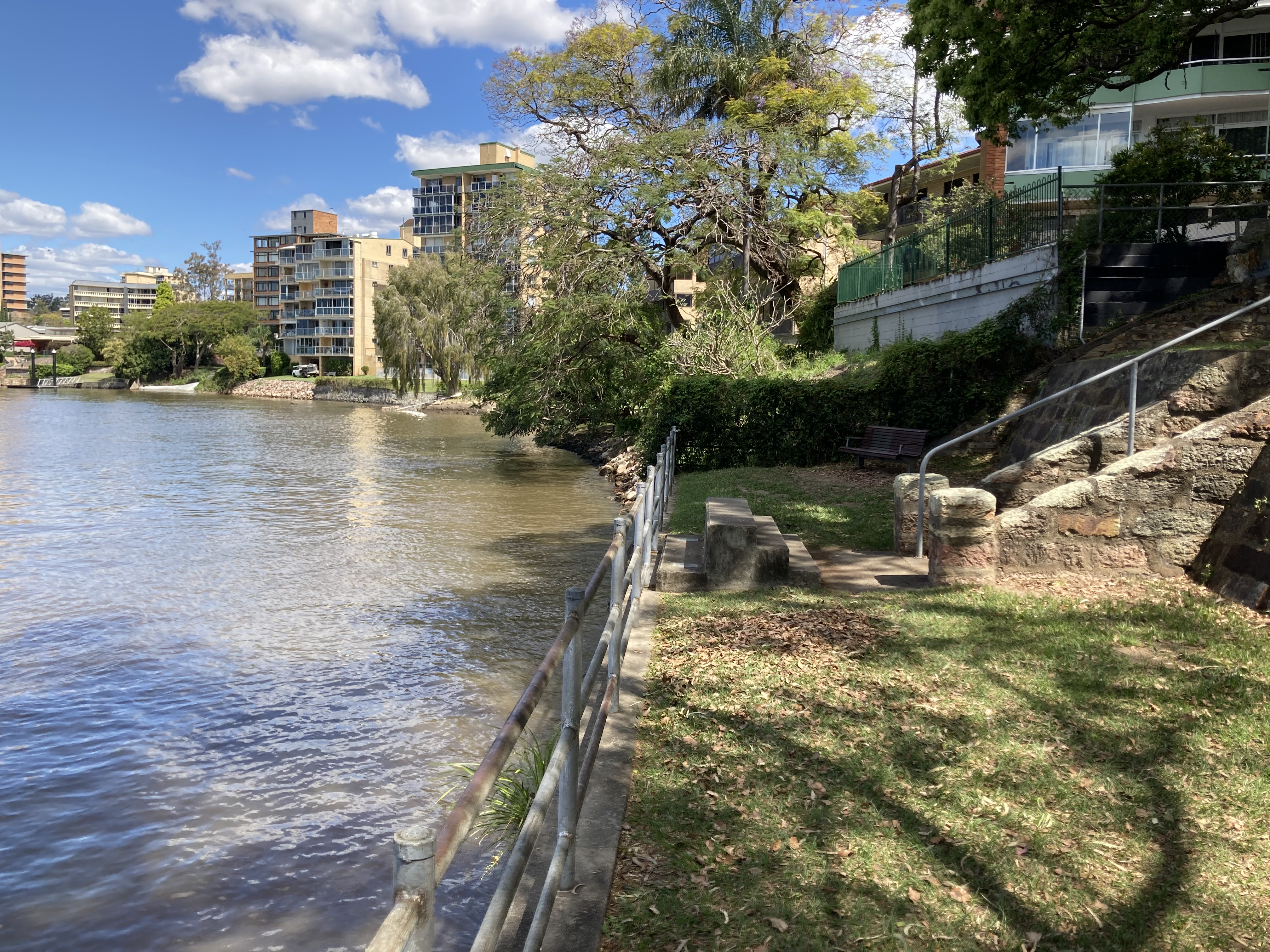
Kayes Rocks occupies a rectangular wedge of land on the east stub end of the Glenny Street road reserve at a bend on Brisbane Street running parallel to the Brisbane River as it turns from the St Lucia Reach into the Toowong Reach. The reserve stands between privately owned properties, a block of apartments to the south and a single freestanding residence to the north.
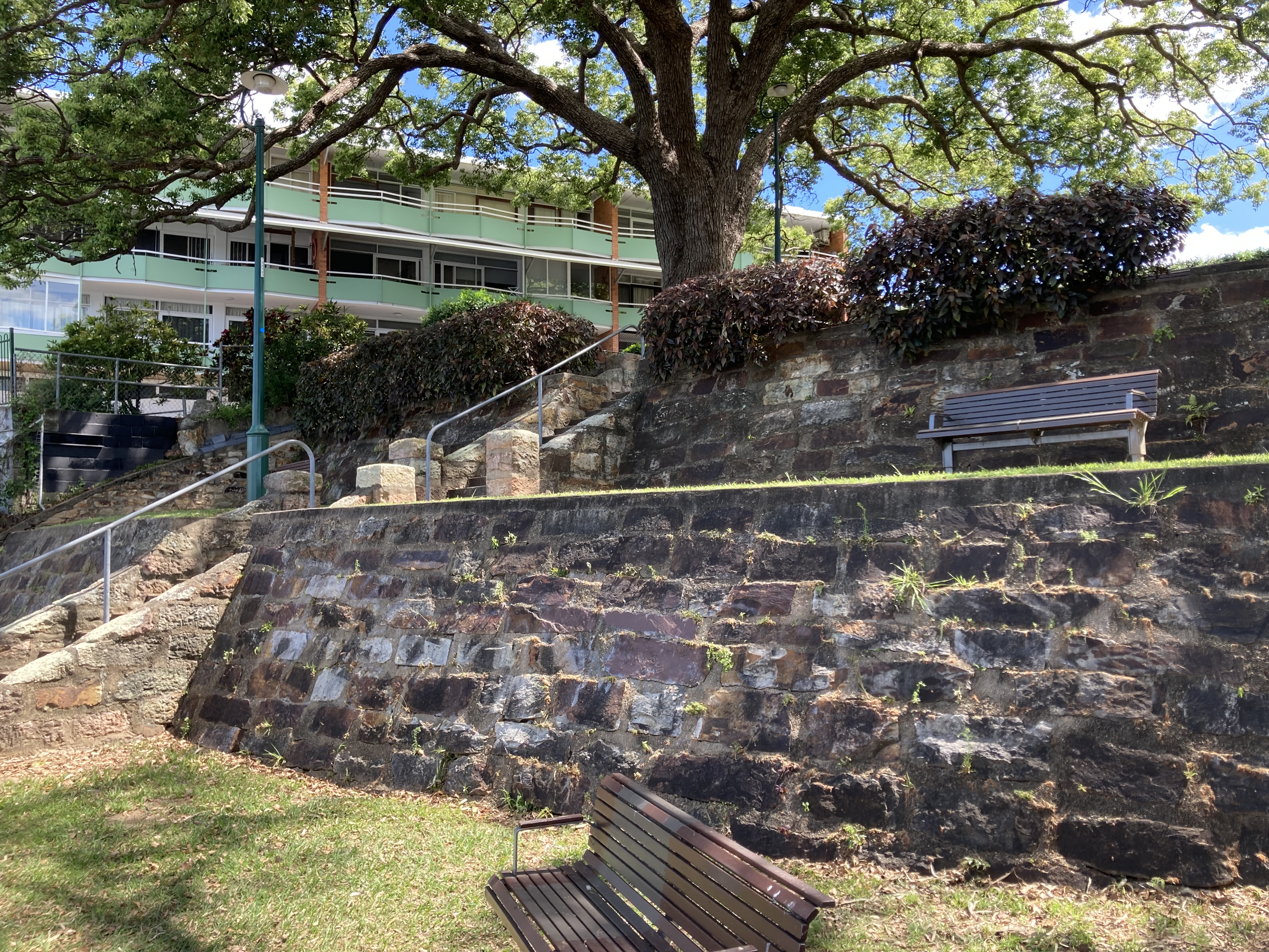
Kayes Rocks is a series of five terraces and stone retaining walls dropping from a flat pad at road level down the steep slope to the rocky river edge. The landscaped terraces are approached through a bitumened carpark off Brisbane Street. A murraya hedge forms a screen between the terraces and the carpark and is planted west of the low stone wall which marks the edge of the first terrace. From Brisbane Street, the Kayes Rocks is distinguished by the large exuberant canopy of a camphor laurel tree planted to the south on the second terrace.
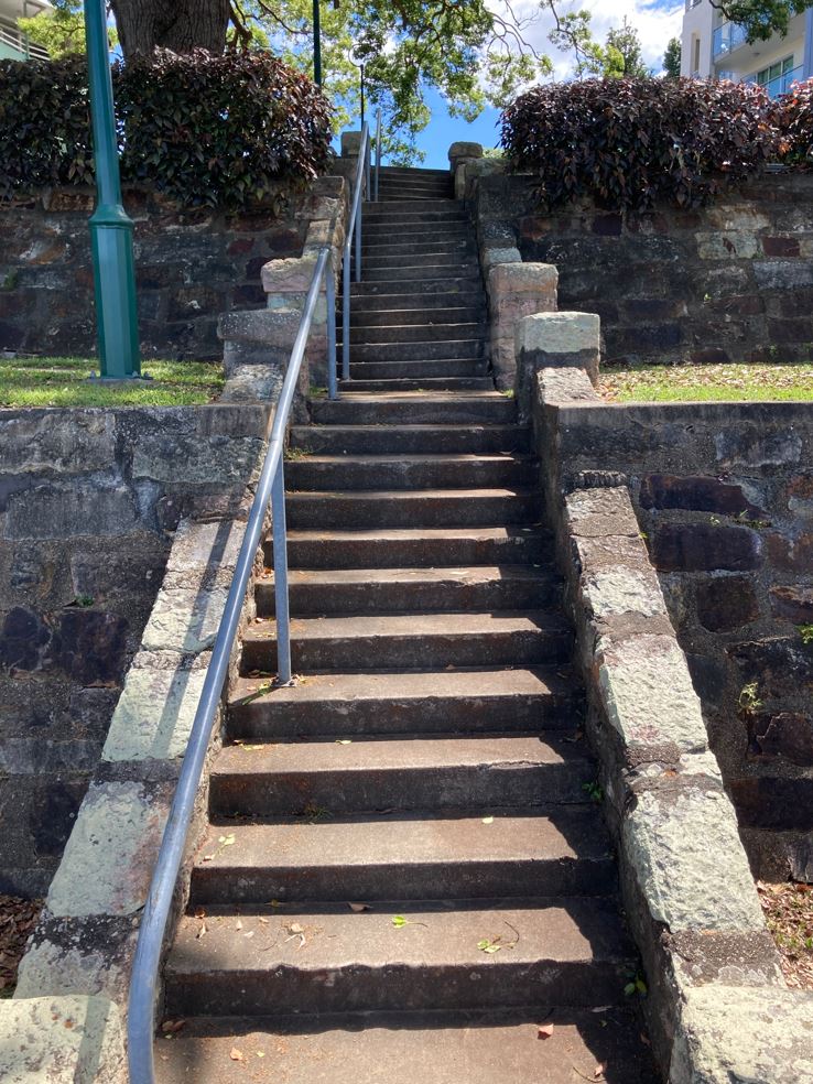
The terraced area is approximately 30m x 20m and falls approximately 8.5m from the road level to the lower terrace. All terraces are grassed and the first and middle terraces have low trimmed hedges to the east edges. Seats stand on concrete slabs on all but the first terrace. A narrow concrete path threads through the middle of the site with sets of concrete and stone stairs travelling from terrace to terrace.
The stone retaining walls are composed of rough hewn stones set in a concrete mortar. The walls have a slight batter from top to bottom and curve gently out to the east. A set of concrete stairs with a narrow platform stands to the river edge of the lower terrace. Decorative metal light poles stand to the south of the path on terraces 2 and 4. The lower terrace is enclosed with a fence of round metal posts with three round metal rails. The terraces afford views across to Orleigh Park and of the Brisbane River up and down stream.
A brief inspection of Kayes Rocks reveals that the place is in a satisfactory condition. Some of the stone walls have been vandalised by graffiti and there is evidence of cracking and movement in a number of stair piers.
Statement of significance
Relevant assessment criteria
This is a place of local heritage significance and meets one or more of the local heritage criteria under the Heritage planning scheme policy of the Brisbane City Plan 2014. It is significant because:
References
-
Brisbane City Council - City Assets Branch Conservation Management Study Stage 1 Report. November 2002
Citation prepared by — Brisbane City Council (page revised October 2022)