Addresses
Type of place
Tree/s
Period
Federation 1890-1914
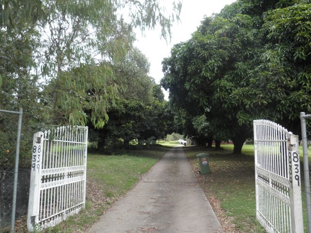

This is an image of the local heritage place known as Avenue of mango trees
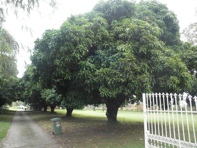
This is an image of the local heritage place known as Avenue of mango trees 1
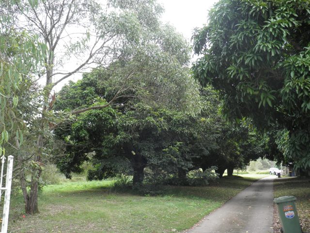
This is an image of the local heritage place known as Avenue of mango trees 2
Avenue of mango trees
Addresses
Type of place
Tree/s
Period
Federation 1890-1914
Planted in the early twentieth century, this avenue of mature mango trees is significant for the evidence it provides of the development of the local area (now known as Doolandella) as a farming community.
Lot plan
L1_RP61390
Key dates
Local Heritage Place Since —
Date of Citation —
Criterion for listing
(A) HistoricalInteractive mapping
Lot plan
L1_RP61390
Key dates
Local Heritage Place Since —
Date of Citation —
Criterion for listing
(A) HistoricalInteractive mapping
History
These mature mango trees form an avenue along a private driveway leading to a house at 839 Blunder Road. It is likely that they were planted by the owner of the five acre property in the 1910s or 1920s.
The land on which the trees are situated was part of 320 acres sold by Deed of Grant in 1879 to James Connors. In 1902, it was purchased by John McCotter, a railway employee of Sandgate. It appears that McCotter made a major change in occupation as by 1904, a John McCotter is listed in post office records as “farmer, Oxley”. It is likely that the mango trees were planted by McCotter to mark the entrance to his home in the traditional European manner, signifying a change from bushland to civilization.
This species of mango tree, Mangifera indica was probably introduced to Queensland in the mid-to-late 19th century during Walter Hill’s curatorship of the Botanic Gardens. At this time, various species of economic potential were sourced and distributed, a practice which continued into the early 1900s.
John McCotter mortaged his property several times between 1903 and 1925. The largest mortgage was for 1 000 in 1906. As the 1910s postal records reveal two John McCotters living at Oxley, it is possible that this was a family farm supporting more than one generation. Some smaller buildings are visible at the rear of the main house on the 1946 aerial photograph. One of these may have been another residence. Alternatively, one or both John McCotters may have lived elsewhere in the Oxley district.
In 1925, the titles of the property were transferred to Thomas Vincent McCotter who sold the land the following year to Anna Fredriksen, wife of Kristian Hendrick Fredriksen. Five acres of this land was purchased by Thomas Clohessy in 1948. Since that time, the property has changed hands several times. Council building records indicate that a car wrecking business was established on the site in 1961 and a new dwelling built in 1973.
According to Brisbane City Council’s arborist, these mango trees were probably around 30 or 40 years old when the 1946 aerial photograph of the area was taken. This places their current age at approximately 80 – 90 years. The house visible in the 1946 aerial photos has since been removed and replaced with a more modern home. The photograph also shows three large trees in a row to the south of the original house, probably built as a windbreak. These have also survived but are less visible from the road.
The 1946 aerial photograph provides a historical snapshot of the area. At this time, the house at 839 Blunder Road was one of only 4 or 5 residences in what is now the suburb of Doolandella. These residences are set amongst small farms and orchards along Blunder Road. The majority of the area was still bushland. By 1951, some dozen homes on large allotments stretched south along the length of Blunder Road. Brookside Street was the only other road built at this time.
Since the 1950s, this area has continued to develop, acquiring official recognition as a suburb and the name of Doolandella. It has, however, retained its rural atmosphere and bushland setting.
The mango trees at 839 Blunder Road, with their thick trunks and large, dense canopies, are visible from the road and provide evidence of early European settlement in this locality.
Description
The avenue is formed by two rows of mature trees of the Mangifera indica species, five on the southern side and six to the north. The trees are approximately 10 metres in height and 12 metres wide.
Statement of significance
Relevant assessment criteria
This is a place of local heritage significance and meets one or more of the local heritage criteria under the Heritage planning scheme policy of the Brisbane City Plan 2014. It is significant because:
References
-
Brisbane City Council 1946 and 1999 aerial photographs
-
Brisbane City Council Building Records
-
Brisbane City Council City of Brisbane Land Use Maps 1951
-
Department of Natural Resources, titles information
-
Queensland Post Office Directories
-
Information kindly provided by Lyndal Plant, BCC Landscape Amenity Section
Citation prepared by — Brisbane City Council (page revised September 2020)