Addresses
Type of place
Church
Period
Postwar 1945-1960
Style
Free Gothic

St Johns Lutheran Church
St Johns Lutheran Church
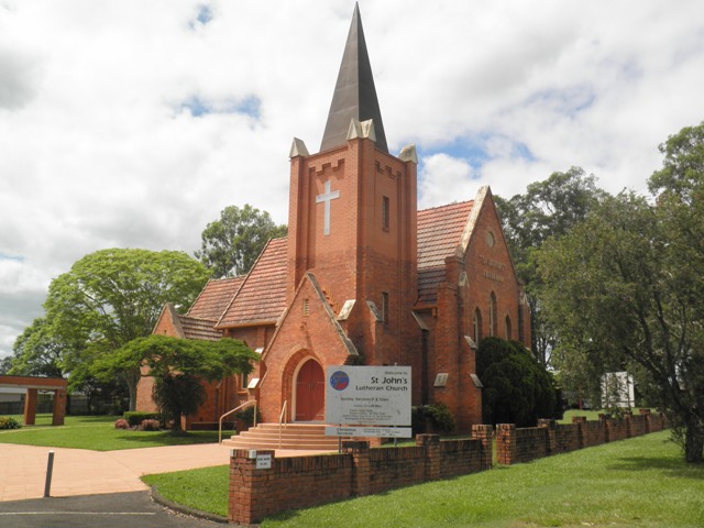
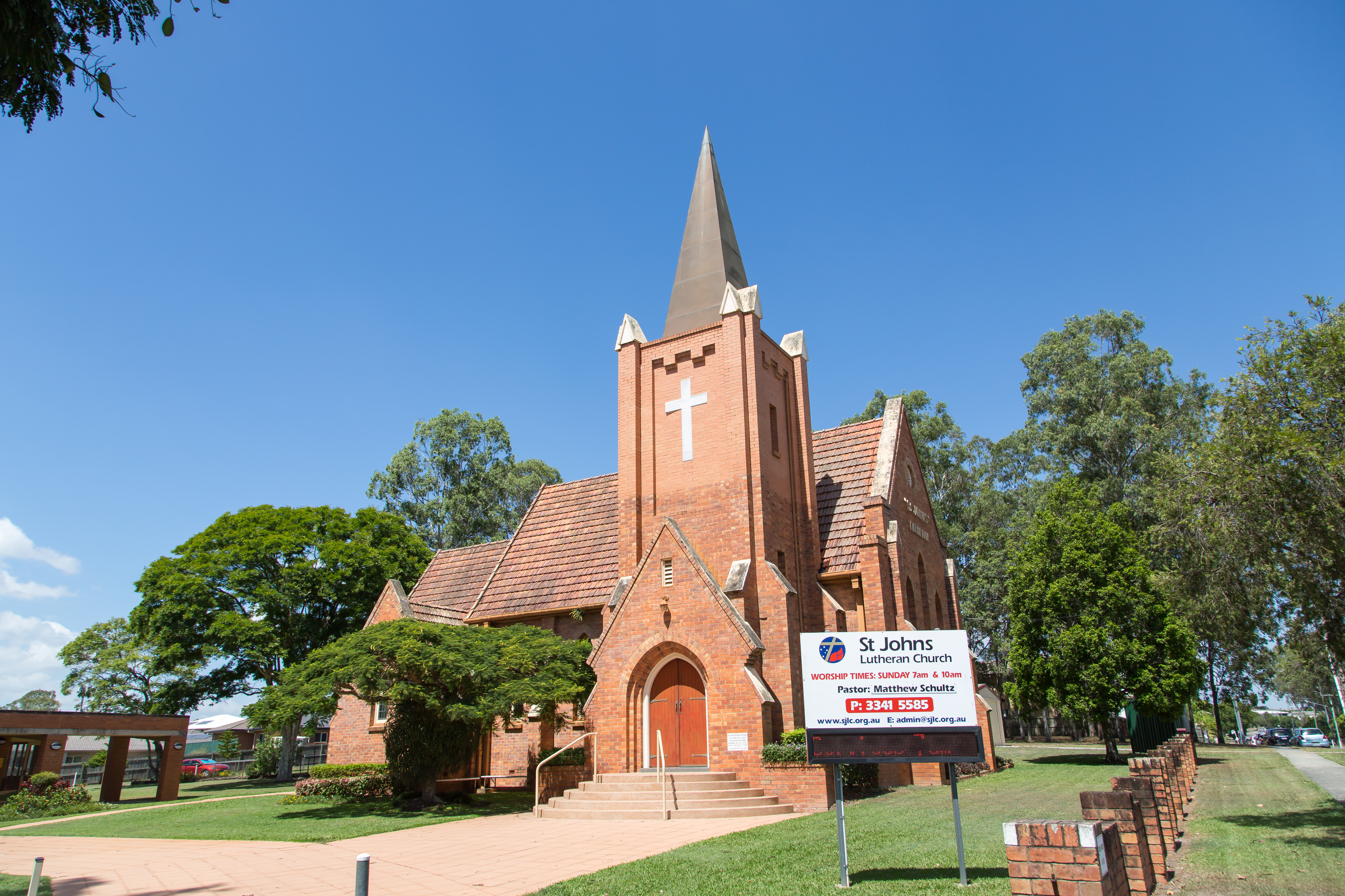
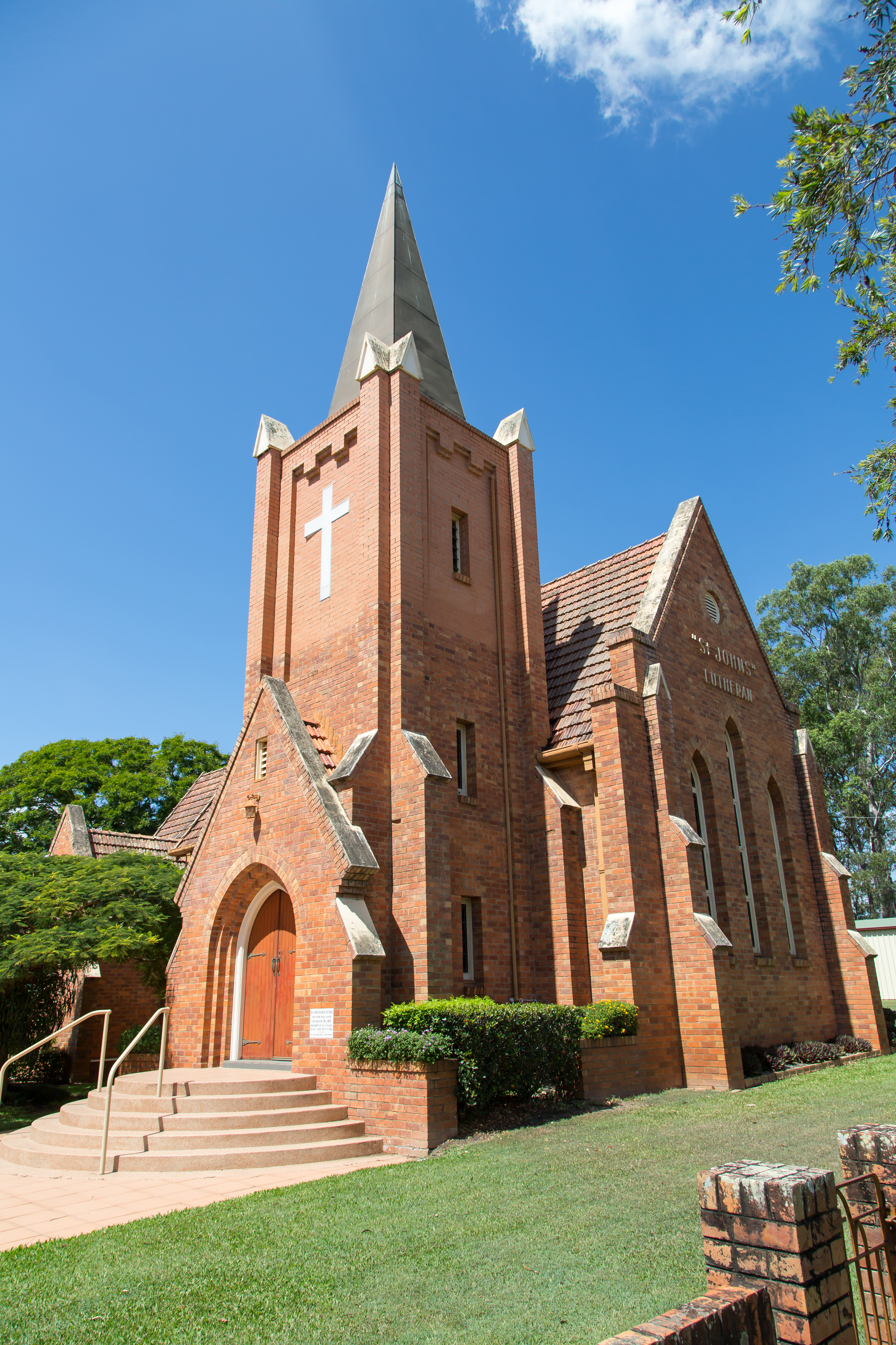
This is an image of the local heritage place known as St Johns Lutheran Church
St John's Lutheran Church
Addresses
Type of place
Church
Period
Postwar 1945-1960
Style
Free Gothic
The St John’s Lutheran Church was officially opened by Pastor M. Lohe on 9 December 1951. This elegant brick church was designed by congregation member, Reg Waldman, who also supervised the construction of the building. The church was built using volunteer labour drawn from the local community. In 1976, the design was completed when a new spire was placed on the church.
The large site includes a hall (1954), manse (1960s) and kindergarten/preschool (circa 1972) which are not included in the current heritage listing.
Lot plan
L1_RP169907
Key dates
Local Heritage Place Since —
Date of Citation —
Construction
Roof: Terracotta tile;Walls: Face brick
People/associations
Reg Waldman (Architect);Volunteer Labours (Builder)
Criterion for listing
(A) Historical; (G) Social; (E) AestheticInteractive mapping
Lot plan
L1_RP169907
Key dates
Local Heritage Place Since —
Date of Citation —
Construction
Roof: Terracotta tile;Walls: Face brick
People/associations
Reg Waldman (Architect);Volunteer Labours (Builder)
Criterion for listing
(A) Historical; (G) Social; (E) AestheticInteractive mapping
History
This brick, Gothic style church at Eight Mile Plains was officially opened on 9 December 1951. The church was designed by Mr Reg Waldman, a member of the congregation, and built by volunteer labour.
Eight Mile Plains developed as a coach stop on the route through Logan to the South Coast in the mid-nineteenth century. A general store and blacksmith’s shop were among the earliest buildings constructed and, in 1863, Baker’s Hotel (later known as the Eight Mile Plains Hotel) opened on the site of today’s Glen Hotel. A post office opened in the hotel in 1868 and a primary school was built in 1869. The residence of ‘Hughesville’, built on Logan Road in 1892-93 for the Hughes family, later became a landmark for travellers to the South Coast.
A United Protestant Church was constructed on Millers Road between 1902 and 1904 and this served as a meeting place for various faiths until local congregations were able to build their own churches. Eight Mile Plains remained a mostly agricultural community of farmers, fruit growers and poultry farmers until the post war period when the population was around 800. The local population continued to increase through the 1960s and 1970s, reaching 3,334 by 1981.
The Lutheran Church began acquiring land in Levington Road (then named Baker Road after an early landholder) in 1948 when it purchased over half an acre from Friedrick Fels. Another 30 perches was purchased from Ernest and Grace Collett in 1949. Once work on the new brick church was commenced, progress was slow as the building was constructed with volunteer labour from the local community. It was not until 2 April 1950 that Pastor M. Lohe, the Lutheran Church Queensland president, laid the foundation stone of the church and a further 18 months before the church officially opened.
The new church was opened by Pastor M. Lohe on 9 December 1951. The Courier Mail reported that around 30 members of the church worked for some 10,000 hours to construct the building using 75,000 bricks. The cost of building once the tower was completed was expected to reach £3,000.
In 1965, the Lutheran Church acquired another acre of land to add to the site, followed by an additional acre in 1968. In 1976, a spire was added to the tower, completing the design of Reg Waldman. The site was enlarged again in 1981 when the Church bought 1.137 hectares from the Colletts. Today the site covers an area of 11 370m².
Additional buildings which have been added to the site include a church hall in 1954 (constructed from two ex-army huts), a manse constructed during the 1960s and a kindergarten/preschool built circa 1972. These buildings are not included in the local heritage listing.
Description
This red brick gothic brick church features a square tower with a large spire behind the gabled main entrance. The terracotta roof has a multi-gabled form.
Broad circular steps lead to the gothic arch of the entrance. The church has several gothic windows including three on the western wall of the nave.
The church is set in landscaped grounds which include several mature trees and a low brick wall along the front boundary to Levington Road.
Statement of significance
Relevant assessment criteria
This is a place of local heritage significance and meets one or more of the local heritage criteria under the Heritage planning scheme policy of the Brisbane City Plan 2014. It is significant because:
References
-
Brisbane City Council (BCC) aerial photographs.
-
Brisbane City Council Building Cards
-
Greave, Betty, telephone interview with BCC Heritage, 6 February 1991
-
State Library of Queensland. John Oxley Library, photographic collection
-
Queensland Certificate of Title
-
Courier Mail, 10 Dec 1951. NLA Trove website. Viewed 10 Sep 2013
-
Logan City Council Libraries, “Mt Gravatt and Eight Mile Plains Districts”. http://www.logan.qld.gov.au/__data/assets/pdf_file/0004/74767/6558573-Handout20-MtGravatt-EMP.pdf , viewed 13 Sep 2013
-
Letter from Owen Scholl, Executive Officer, St John’s Lutheran Church, to Brisbane City Council Heritage Unit, 17 Jul 2003
-
Brisbane City Council Kuraby District Local Area Plan: Character Study. July 1996
-
Centre for the Government of Queensland. ‘Eight Mile Plains’. http://queenslandplaces.com.au/node/310. Viewed 13 Sep 2013
Citation prepared by — Brisbane City Council (page revised September 2020)