Addresses
Type of place
Flat building, Shop/s, Shophouse
Period
Federation 1890-1914
Style
Art Deco, Free Style
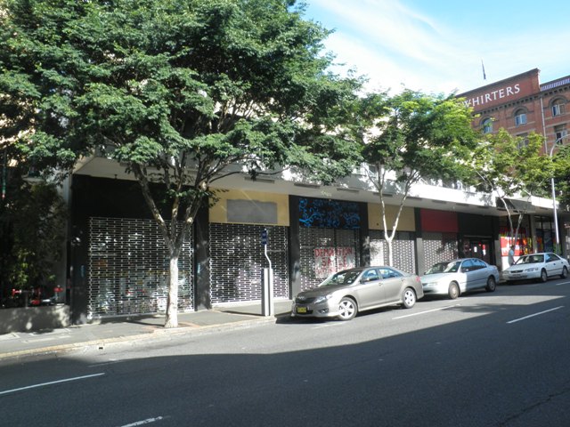

This is an image of the local heritage place known as Myers House
Myers House
Addresses
Type of place
Flat building, Shop/s, Shophouse
Period
Federation 1890-1914
Style
Art Deco, Free Style
Constructed circa 1890, this two-storey painted brick building is a surviving example in Fortitude Valley of a row of commercial terraces with former residential accommodation above. Designed by prominent nineteenth century architectural firm John Hall & Son, it reflects the commercial growth of Fortitude Valley during the 1890s, a period in which most areas suffered depression.
Lot plan
Key dates
Local Heritage Place Since —
Date of Citation —
Construction
Walls: Brick - PaintedPeople/associations
John Hall and Son (Architect)Criterion for listing
(A) HistoricalInteractive mapping
Lot plan
Key dates
Local Heritage Place Since —
Date of Citation —
Construction
Walls: Brick - PaintedPeople/associations
John Hall and Son (Architect)Criterion for listing
(A) HistoricalInteractive mapping
History
After acquiring the land in 1888, accountant and philanthropist Henry James Oxley contracted prominent architects John Hall & Son to design this terrace building. Prior to this the Wickham Street block between Ballow and Warner Streets was vacant. Oxley took out a substantial mortgage of £6,000 in 1889, possibly to finance the construction of this building, and another in 1890. The property was quickly tenanted, but throughout 1891-1895 a number of the six shops and dwellings remained vacant. Oxley appears to have fallen into difficult times – the economic depression was at its height in the early part of the 1890s – and in 1894 the property was transferred to his mortgagees.
Despite the depression, the 1890s were a significant period in the expansion of the Valley as a retail centre. The disastrous floods of 1890 and 1893 caused extensive damage to stores on the south side of the river and cut them off from the town centre. This prompted many retailers, such as TC Beirne, to move to the north side of the river. In the late 1890s all three major Valley stores – TC Beirne, McWhirters and Overell’s – expanded their businesses considerably. The extension of the train line from the city to Fortitude Valley also contributed to the growth of industry.
During this early part of the twentieth century the premises at 253-263 Wickham Street were tenanted by a number of small merchants, many of whom manufactured and sold their goods directly from the premises. They included at various times, a plumber, carpenter, milliner and tobacconist. On at least one occasion one of the terraces was used solely as a dwelling, but this is uncommon, with the majority of tenants appearing to operate businesses from the address, while residing above.
The 1920s were a decade of economic growth throughout Brisbane. The Valley in particular, with its success as a commercial and industrial hub, expanded even further. Electric trams, which passed the busy corner of Brunswick and Wickham Streets, brought thousands of shoppers to the Valley. The first stage of the McWhirters building that had been completed in 1912 was extended in 1923.
Wickham Street was affected by road widening and remodelling at the junction of Ann, Queen and Wickham Streets that occurred during the 1920s. In 1923 the Brisbane Municipal Council resumed properties in Wickham Street where it met Ann and Queen Streets for this purpose. In this decade the cutting on Duncan’s Hill for Ann Street was widened opening the Valley even more to the rest of Brisbane. Some of the older commercial premises in Wickham Street were given ‘modern’ facelifts between 1921 and 1928, with some ornamentation being removed to give a simpler, sleeker appearance. It is during this period that these terrace shops in Wickham Street would appear to have undergone similar cosmetic changes to the front façade.
Continuing to maintain its occupancy type, the row of terrace shops was tenanted by bootmakers, a costumier and a confectioner during the decade of the 1910s. Long term tenants such as a launderer from 1914 until the late 1930s and Kloake’s tobacconist for twenty years from the late 1920s until 1948 show the continuity of use as commercial premises. By 1951 the premises were identified as Myers House, a name that was still evident on the façade of the building as late as 1995.
Description
This two-storey painted brick building is divided into six symmetrical bays creating a visual reflection of the internal subdivision into tenancies. The upper floor of each bay contains two narrow windows, above which a rendered and painted horizontal bank once featured the name “Myers House”. A parapet with detailed cornice surmounts the second floor. The ground level has shopfronts with plate glass windows and a suspended awning covers the footpath.
Statement of significance
Relevant assessment criteria
This is a place of local heritage significance and meets one or more of the local heritage criteria under the Heritage planning scheme policy of the Brisbane City Plan 2014. It is significant because:
References
-
Brisbane City Council aerial photographs, 1946, 2005, 2009
-
Brisbane City Council Archives, Survey plan, 1916
-
Brisbane City Council Department of Water Supply and Sewerage Detail Plan, circa 1924
-
Brisbane City Council, Properties on the Web, Building Cards
-
Brisbane City Council Heritage Unit, Fortitude Valley Heritage and Character Study, 1995
-
Lawson, Ronald. Brisbane in the 1890s: a study of an Australian urban society ( St Lucia, Queensland: University of Queensland Press, 1973)
-
National Library of Australia, Trove newspapers, Brisbane Courier, The Queenslander, Courier Mail
-
Queensland Post Office Directories
-
Department of Natural Resources and Mines, Queensland Certificate of Title and other records
Citation prepared by — Brisbane City Council (page revised September 2020)