Addresses
Type of place
Drainage, Ferry terminal
Period
Victorian 1860-1890, Federation 1890-1914
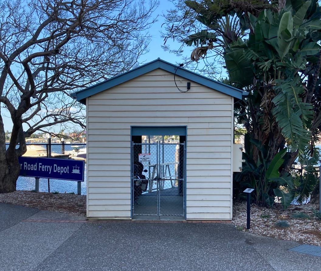

Merthyr Road Ferry Terminal (former)
Merthyr Road Ferry Terminal (former) remnant elements and Headwall & Outfall
Addresses
Type of place
Drainage, Ferry terminal
Period
Victorian 1860-1890, Federation 1890-1914
The northern end of Merthyr Road contains evidence of major late 19th and early 20th century municipal works, including a former cross-river ferry service and drainage works.In 1888 plans were drawn up for main intercepting drains to service the Merthyr Road due to public health concerns. The porphyry river walls lining the ferry landing and surrounding the sewer outlet were probably built about 1913. Drainage works remaining include the porphyry river retaining wall incorporating steps and drain outfall as well as porphyry gully trap in kerb. By mid-1905 a cross-river ferry service was operating between Merthyr Road, New Farm and Hawthorne Street, Bulimba. In 1908 Balmoral Shire Council, which maintained the Merthyr Road facilities, organised for a large floating kiosk to be used as a temporary terminal. In 1913 it was replaced by the ‘Merthyr Road Ferry Depot’ which operated until the introduction of the CityCat service in 1996.
Also known as
Merthyr Road Ferry Terminal (former) remnant elements
Geolocation
-27.462379 153.050872
Key dates
Local Heritage Place Since —
Date of Citation —
Criterion for listing
(A) Historical; (B) Rarity; (E) AestheticInteractive mapping
Also known as
Merthyr Road Ferry Terminal (former) remnant elements
Geolocation
-27.462379 153.050872
Key dates
Local Heritage Place Since —
Date of Citation —
Criterion for listing
(A) Historical; (B) Rarity; (E) AestheticInteractive mapping
Statement of significance
Relevant assessment criteria
This is a place of local heritage significance and meets one or more of the local heritage criteria under the Heritage planning scheme policy of the Brisbane City Plan 2014. It is significant because:
References
-
Brisbane City Council, 1946 aerial photographs.
-
Brisbane City Council, Sewerage Maps, Detail Plan No 184, 1914
-
Brisbane City Council, Brisbane Images, Passengers boarding Hawthorne Ferry at Merthyr Road Terminal, 1934
-
Brisbane City Council, Sewerage Maps, Detail Plan No 184
-
Brisbane City Council, New Farm and Teneriffe Hill Heritage and Character Study, Oct 1995.
-
Draft Newstead and Teneriffe Waterfront Development Control Plan, Brisbane City Council, Dec 1994, Heritage Place no 37, Hawthorne Ferry Terminal Precinct
-
Heritage Unit, Brisbane City Council. Newstead Heritage Study. 1994
-
Conservation Management Study Site Report September 2002
-
Brisbane Courier, 24 Feb 1913, pg 8
Citation prepared by — Brisbane City Council (page revised October 2022)