Addresses
Type of place
Natural feature
Period
World War II 1939-1945

Einbunpin Lagoon
Einbunpin Lagoon
Einbunpin Lagoon
Einbunpin Lagoon
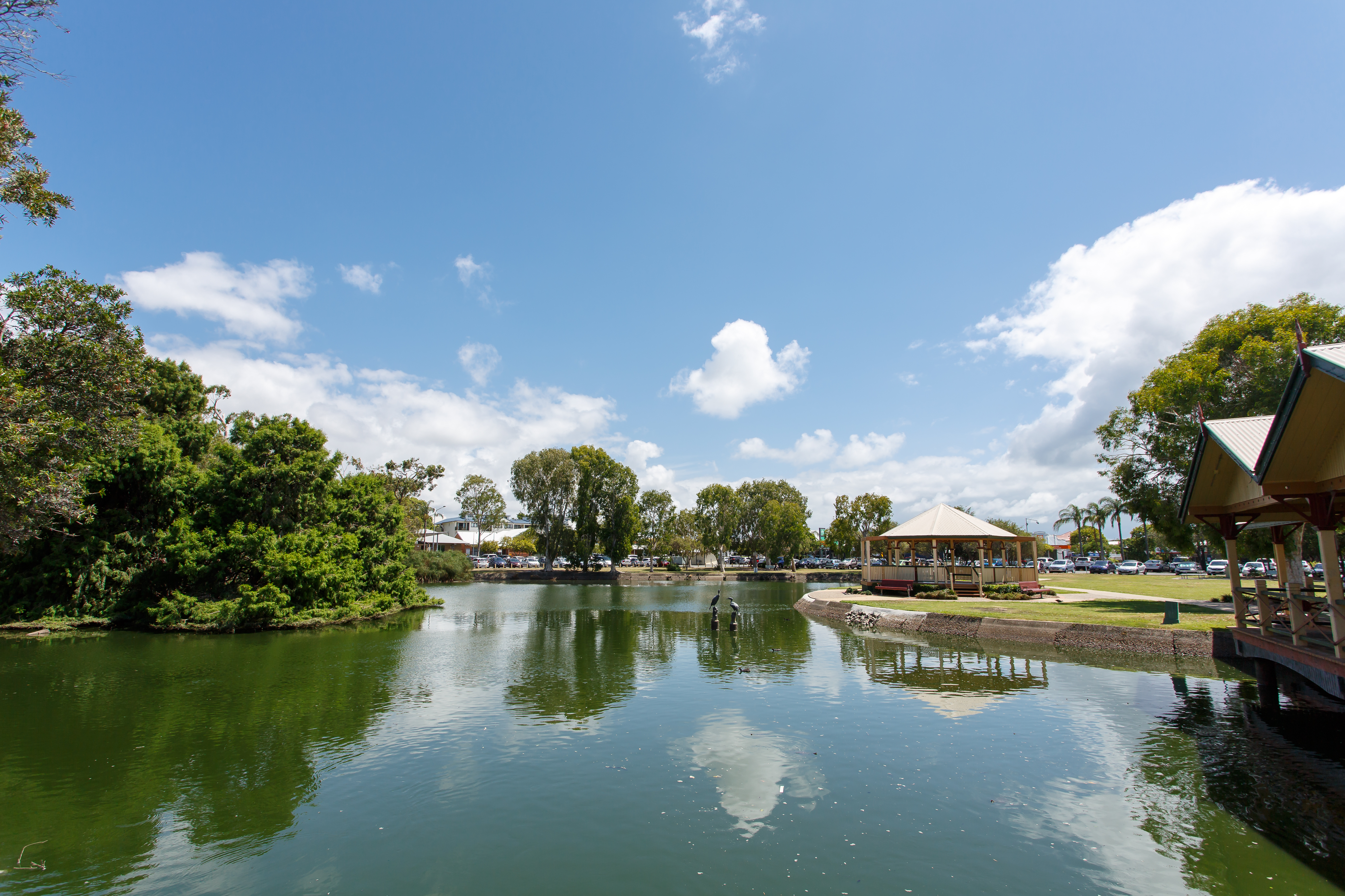
Einbunpin Lagoon Rotunda
Einbunpin Lagoon
This is an image of the local heritage place known as Einbunpin Lagoon
Einbunpin Lagoon
Addresses
Type of place
Natural feature
Period
World War II 1939-1945
As a distinctive natural landscape feature, Einbunpin Lagoon is important for its association with the development of the urban fabric of the district. Important as part of a complex ecosystem of wetland parks, Einbunpin Lagoon has been diminished by and remains threatened by encroaching urban fabric and accompanying toxic stormwater run-off. A scenic backdrop to the business and civic activities of the centre of Sandgate, Einbunpin Lagoon is an important visual element in the streetscape.
Lot plan
L293_SP159020
Key dates
Local Heritage Place Since —
Date of Citation —
Criterion for listing
(A) Historical; (B) Rarity; (E) AestheticInteractive mapping
Lot plan
L293_SP159020
Key dates
Local Heritage Place Since —
Date of Citation —
Criterion for listing
(A) Historical; (B) Rarity; (E) AestheticInteractive mapping
History
The bayside suburb of Sandgate was known to the indigenous peoples as “Moora” or “Warra”, open sheet of water. The area offered abundant food resources in the lagoons, mangroves and bushlands. Sandgate has undergone several periods of accelerated development since European colonists first accessed Moreton Bay in 1842. The first land sales took place in 1853 and settlers soon moved into the area taking up land on traditional Aboriginal camp sites located in the open woodlands, surrounding the lagoons, swamps and waterholes and along the sandy foreshores of the bay. The lagoons, long a haven for wildlife became a popular spot for hunting, fishing and duck shooting and were valued for their scenic contribution to the townscape. Scenic natural features dominating the landscape, the lagoons influenced the pattern of settlement of Sandgate. The town centre established itself adjacent to Einbunpin Lagoon and development spread around this Lagoon and across and around Dowse Lagoon.
Einbunpin Lagoon is a wetland park within a group of wetland parks that form Deagon Wetlands which includes a number of smaller wetland parks – Deagon Wetlands Reserve, Third Lagoon, Dowse Lagoon, Einbunpin Lagoon and Brighton Wetlands. These wetlands belong to a string of coastal wetlands in Brisbane’s east and lie on old alluvial plains. These soils become waterlogged after rain, forming swamps and lagoons. The lagoons are not connected by underground aquifers as was earlier supposed, but are individually fed by rain and run-off.
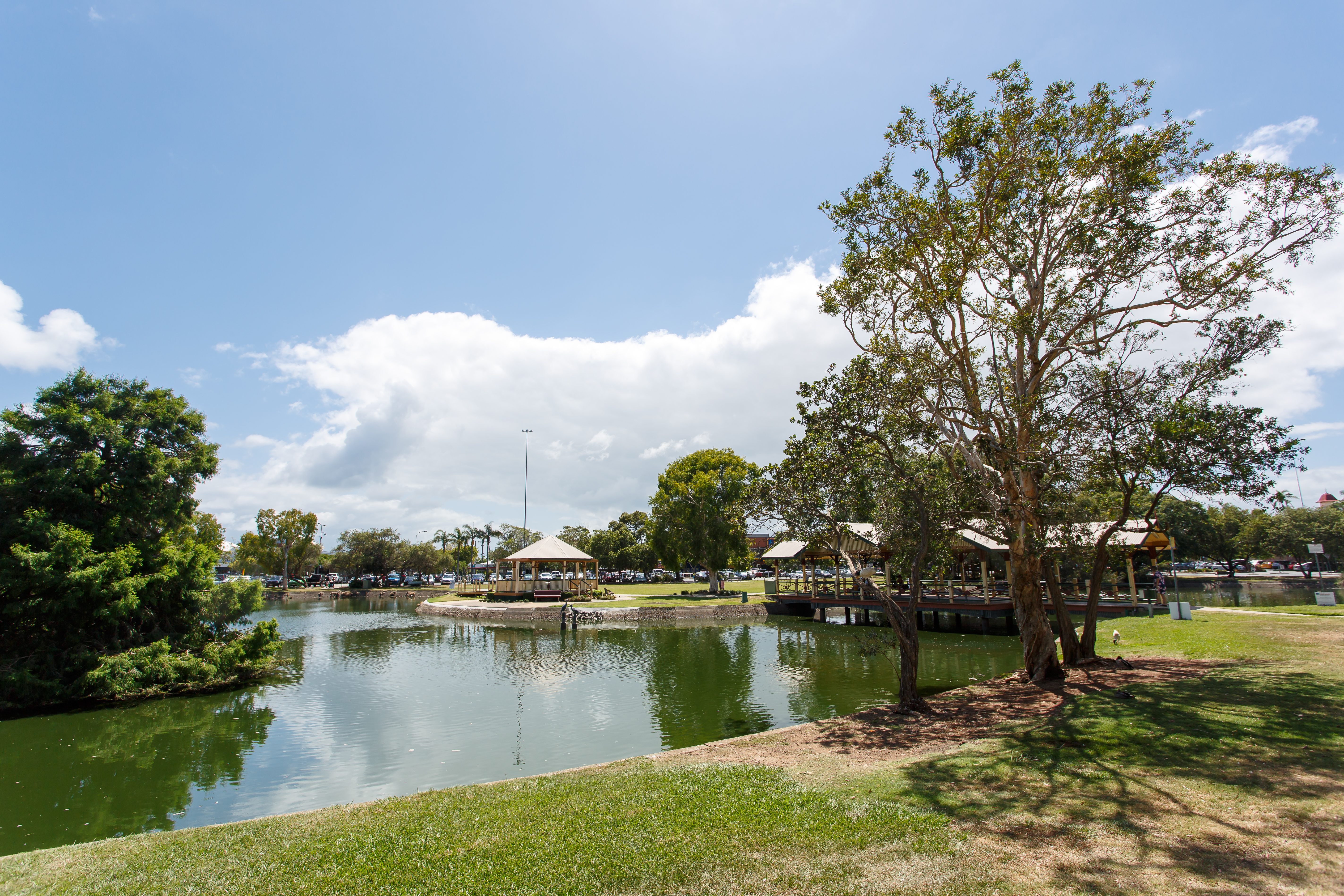
Once a haven for local birds, eels and turtles, Einbunpin Lagoon takes its name from a reed with an edible root familiar to both the Turrbul and Gabi peoples and is one of three lagoons in Sandgate. Located in the centre of Sandgate, Einbunpin Lagoon forms a water park backdrop for the civic, community and retail activities surrounding it.
The Lagoon provided a ready source of water for the town of Sandgate and for the water contractors prior to the provision of reticulated water in the 1920s. The windmill and pumps erected there were a familiar sight until the 1940s. In 1925 the Lagoon was described in a newspaper article as
the rare and beautiful sight… black duck and wood duck, water-hens of all kinds, cranes and shags, and even an occasional pair of black swans.
With encroaching urban settlement, the Lagoon has been plagued with water quality concerns, has been reduced and compromised by resumptions for carparks and roadways and been threatened a number of times with proposals for drainage and filling. In 1934 when moves were made to fill the Lagoon, E.M. Hanlon (MLA) arranged for the area to be declared a bird sanctuary, park and recreation reserve. The Lagoon has suffered with algal bloom and generally with accumulations of rubbish, sludge and hyacinth. Since the 1970s the extent of the Lagoon and surrounds has been considerably reduced to accommodate bitumened carparks to service the town centre. In 1972 beautification of the surrounds was undertaken including the installation of play areas, seating, toilet blocks and landscaping. The Lagoon is the focus of community activities including the Einbunpin Festival.
The Lagoon is now only about one quarter of its original size and remains under threat from encroaching retail development and road proposals.
For further history of the Sandgate district refer to report on Bramble Bay/Sandgate Foreshore in this study.1
Description
In the centre of Sandgate on an almost triangular wedge of land bounded by Brighton Road, Keogh and Lagoon Streets and Bowser Parade, Einbunpin Lagoon Reserve lies northwest of Sandgate Memorial Park and is surrounded by retail, commercial and residential properties and community and civic activities.
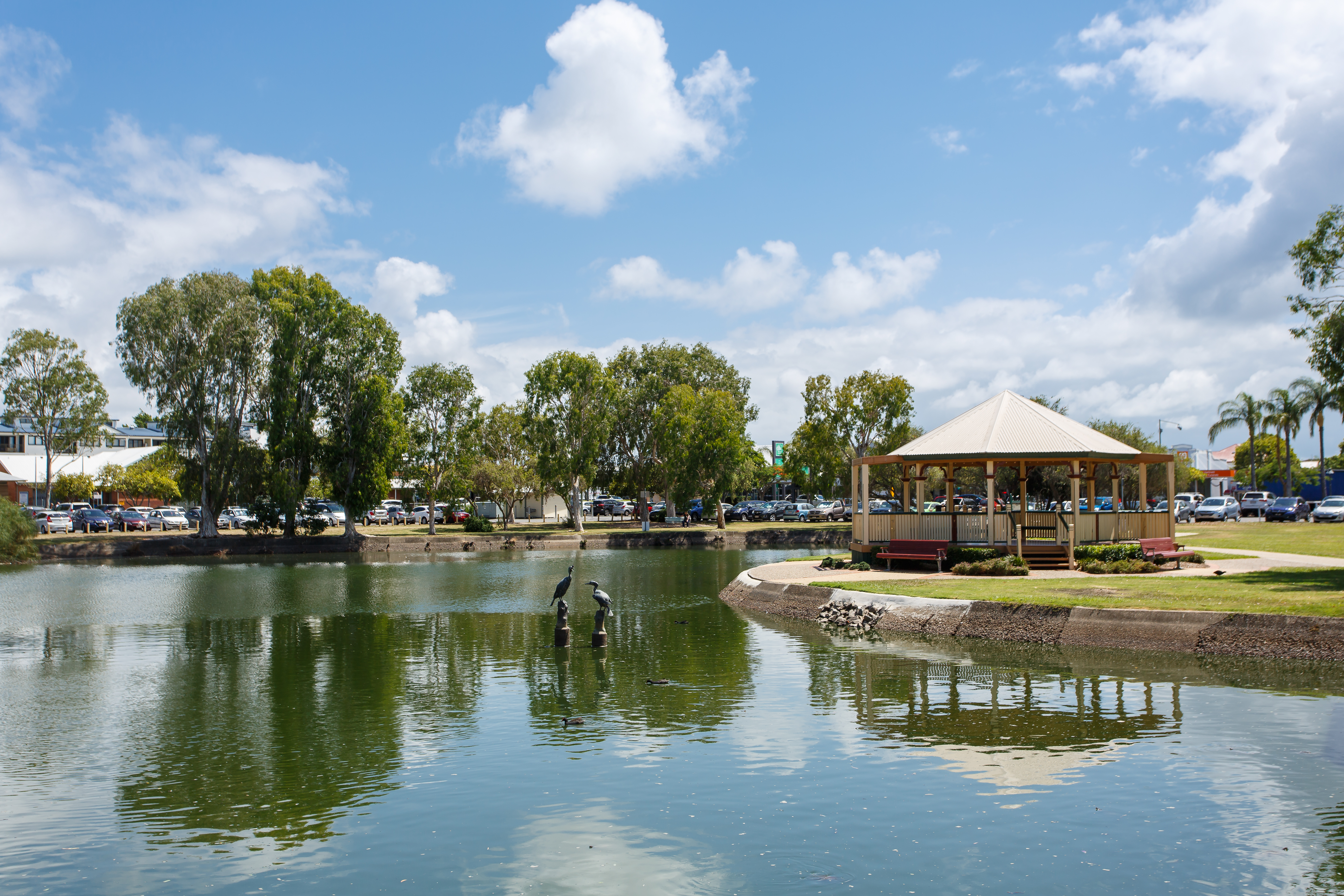
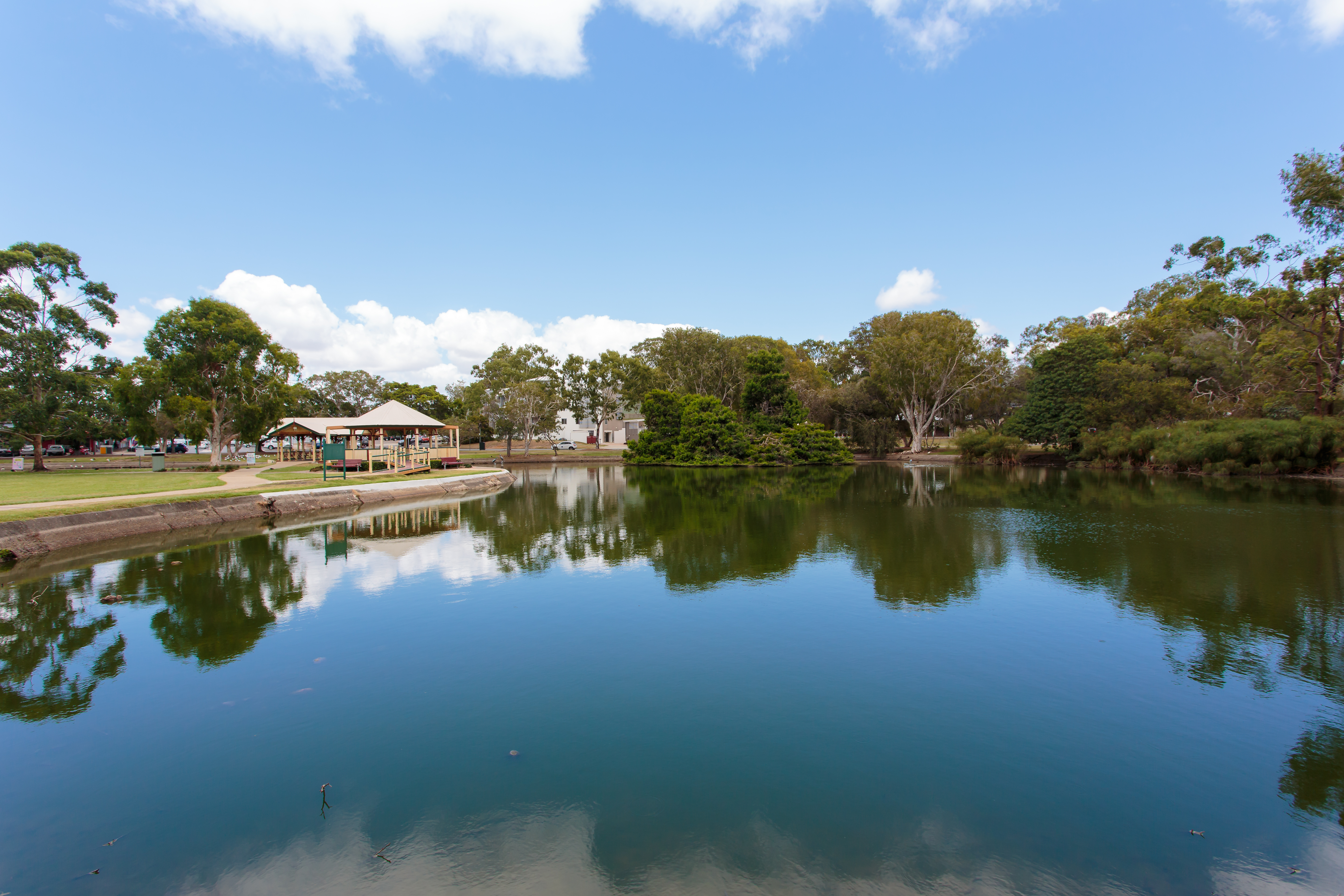
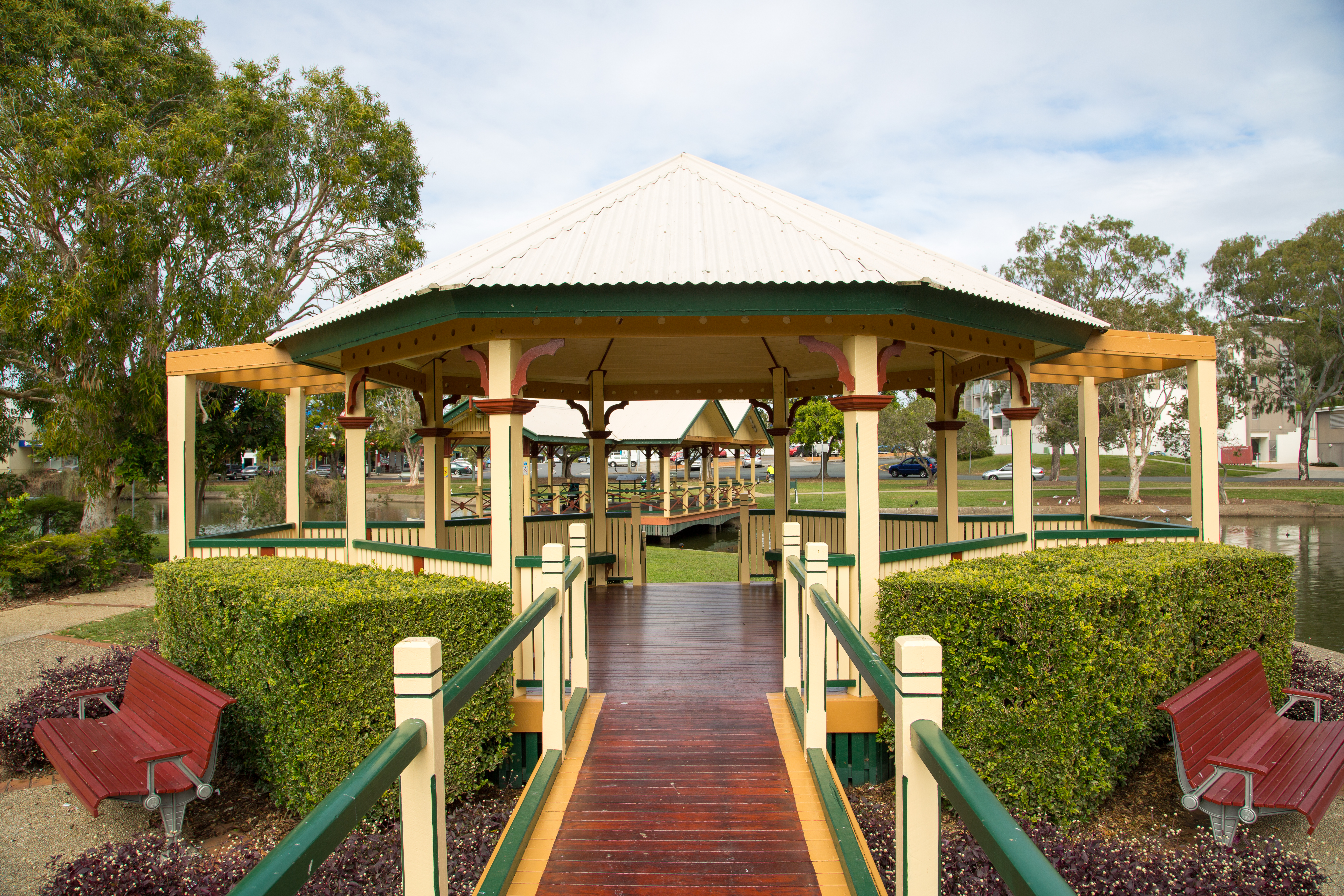
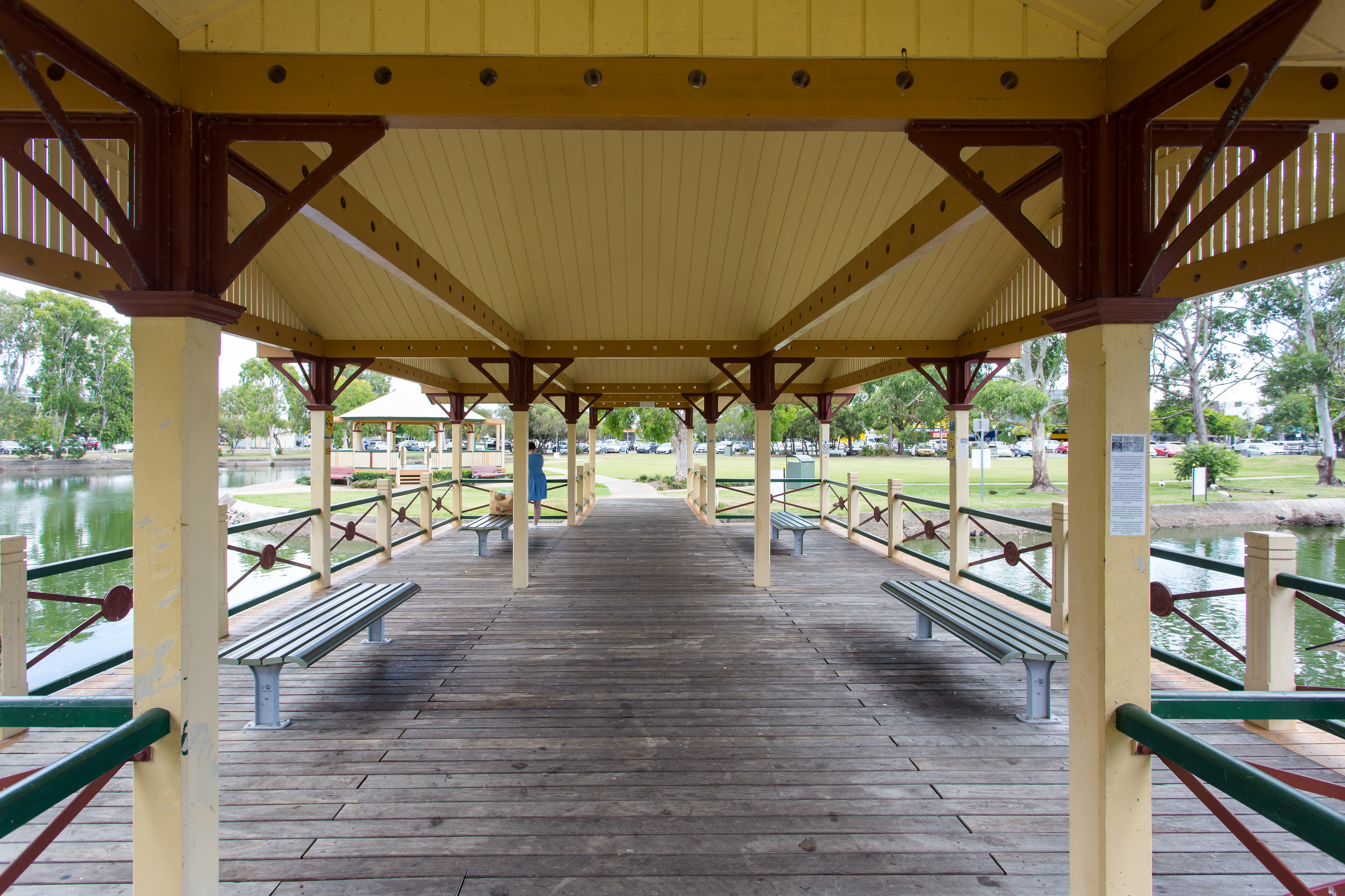
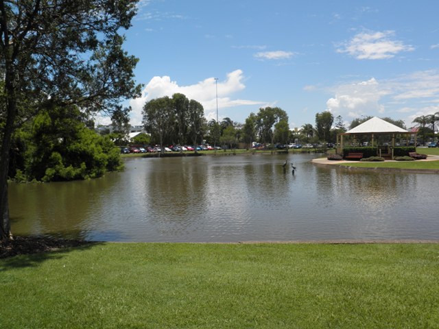
The lagoon, once a free form teardrop-shaped lake, is now a kidney-shaped pond with a concrete edge surround. Bitumened carparks stand to the north and south of the reserve and grassed and treed areas surround the pond which is encircled by a concrete walking path. The pond is crossed by a timber bridge which accommodates an open twin-gable roofed pavilion intersecting with the open gabled walkways to each end. A small treed island stands to the north within the pond. A play area and roofed picnic pavilion stand to the middle of the reserve east of the pond. A freestanding masonry toilet block stands to north of the site and clumps of melaleucas and eucalypts stand to the perimeter.
The lagoons of Sandgate – Einbunpin, Dowse and Third – are a distinctive and recognisable landscape feature of the district providing a scenic backdrop to the townscape and a habitat for wildlife. Only Third Lagoon remains in an essentially natural condition. Located in the centre of Sandgate, Einbunpin Lagoon forms a water park backdrop for the civic, community and retail activities surrounding it.
Now only approximately a quarter of its earlier size, Einbunpin Lagoon has been diminished by encroaching urban fabric, particularly the expanding carparking areas which compromise the Lagoon and are a blight in the streetscape. The Lagoon is plagued by water quality problems, receiving stormwater run-off from the surrounding roadways and shopping centre. In particular, algal bloom is a serious problem for the pond.
Statement of significance
Relevant assessment criteria
This is a place of local heritage significance and meets one or more of the local heritage criteria under the Heritage planning scheme policy of the Brisbane City Plan 2014. It is significant because:
References
-
Brisbane City Council - City Assets Branch Conservation Management Study Stage 1 Report, Part 3 Site Report No. 47. November 2002
-
Brisbane City Council - City Assets Branch Conservation Management Study Stage 1 Report. November 2002
Citation prepared by — Brisbane City Council (page revised September 2020)