Addresses
Type of place
Hall, Park
Period
Interwar 1919-1939, World War II 1939-1945
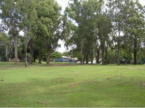

This is an image of the local heritage place known as Hives Park
Hives Park (includes park, scout & guide huts & kindergarten)
Addresses
Type of place
Hall, Park
Period
Interwar 1919-1939, World War II 1939-1945
Around 1930, Charles Vesey Hives, after whom the park is named, offered to sell almost 2 acres of his land to the Brisbane City Council for use as a park and children’s playground. The lease was officially transferred to the Council in 1940, however the land was being used as a park throughout the 1930s and already had a supervisor and caretaker. In 1934, a Scout Hall was built in the park and, after the Council purchased adjoining land in 1944, a Girl Guides hut was also built.
Lot plan
L5_RP82789; L8_RP29589; L9_RP29589; L6_RP82789
Key dates
Local Heritage Place Since —
Date of Citation —
People/associations
Charles Vesey Hives (Association)Criterion for listing
(E) Aesthetic; (H) Historical associationInteractive mapping
Lot plan
L5_RP82789; L8_RP29589; L9_RP29589; L6_RP82789
Key dates
Local Heritage Place Since —
Date of Citation —
People/associations
Charles Vesey Hives (Association)Criterion for listing
(E) Aesthetic; (H) Historical associationInteractive mapping
History
The area from Chelmer to Corinda was known as “Boyland’s Pocket” in the 1850s, Captain Boyland having leased the area in 1851. In 1860 the new Queensland Government opened up the district for selection, at a price of 1 pound per acre, resulting in the establishment of a number of farms ranging anywhere between 25 and 70 acres in size. Attempts were made by pioneer selectors during the 1860s and 1870s to produce maize, potatoes, bananas, cotton, sugar cane, and arrowroot. The opening of a railway bridge at Indooroopilly in 1876 reduced the isolation of the area, and allowed for increased subdivision. The first main building wave occurred in the 1880s, a boom period for Brisbane. However, many of the allotments sold at this time remained vacant for years, and continued to be used for small farming operations. Later waves of building, occurring after each of the World Wars, gradually reduced the amount of farmland, and new housing continues to envelop those gracious older houses which once stood on acreage, surrounded by gardens.
In 1922, Charles Vesey Hives and Mary Ursula Hives purchased 3 acres of land in Sherwood. In the 1921-22 POD, C.V. Hives is listed as living in Albion, and he is not listed again until 1933, when he is listed at Sherwood.
By 1930, Charles was concerned about the cost of rates for the land, since he planned to retire, but he did not want the trees around his homestead to be destroyed if he sold the land for housing. He therefore offered to sell almost 2 acres of this land to the Brisbane City Council, as a children’s playground, for ₤250, payable over 10 instalments of ₤25. This was on the proviso that the land never be built on (excepting the 1 rood, 14.6 perches of lots 8, 9 and 10, facing Quarry Rd). The council accepted, making the final payment in 1939, and title was transferred in 1940, although the land had been used as a park throughout the 1930s. H.G. Coxen was appointed Supervisor and Caretaker in 1930, and a Scout Hall was built on the land facing Quarry Rd in 1934.
The remaining land, where the Hives’ house stood, was transferred to George Whatmore in 1936, before being purchased by the BCC in 1944 (Charles Hives had died in 1940). This land now makes up the north-west corner of the park, and a Girl Guide’s Hut was built there between 1946 and 1957.
In 1956 the Western edge of both parcels of land was resumed for railway purposes. That same year part of the park was leased to the Sherwood-Corinda Pre-School Association, and a building was erected in the north-east corner of the park in 1957. The current park is 2 acres, 3 roods and 8.1 perches in size.
Statement of significance
Relevant assessment criteria
This is a place of local heritage significance and meets one or more of the local heritage criteria under the Heritage planning scheme policy of the Brisbane City Plan 2014. It is significant because:
References
-
Title deeds, Department of Natural Resources and Mines
-
Walter Taylor South Character and Heritage Study, BCC Heritage Unit, 1997
-
Queensland Post Office Directories
-
Brisbane City Council Water Supply and Sewerage Detail Plans
-
Surveyor-General’s Office. McKellar’s Official Map of Brisbane and Suburbs. Brisbane, 1895
-
Brisbane City Council Minutes, 1930, 1933-34, 1956-57
-
Brisbane City Council Building Cards
-
Correspondence Between CV Hives, the Sherwood Progress Association, the BCC, and the Commissioner for Railways
Citation prepared by — Brisbane City Council (page revised July 2025)