Addresses
Type of place
Dam / reservoir, Defence site, Lookout, Reserve
Period
Federation 1890-1914
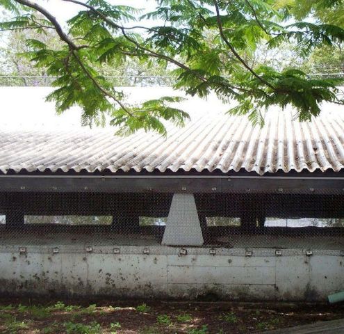

This is an image of the local heritage place known as Bartley's Hill Reservoir
This is an image of the local heritage place known as Bartley's Hill Reservoir
Bartley's Hill Reserve
Addresses
Type of place
Dam / reservoir, Defence site, Lookout, Reserve
Period
Federation 1890-1914
The Bartley’s Hill Reserve, containing water reservoirs and a lookout, is located on a prominent Ascot hilltop. The first concrete reservoir was completed by 1907, providing the surrounding district and places as far away as Teneriffe, Spring Hill and Red Hill with pressurised water delivery. A second reservoir was installed by the end of 1920. From as early as 1925 the hill appears to have been used as a public observation point. Because of its elevation an aircraft observation post was constructed there during WWII. The site also contains remnant stair associated with a 19th century house built on the site.
Lot plan
Key dates
Local Heritage Place Since —
Date of Citation —
Construction
StructurePeople/associations
Nehemiah Bartley (Association)Criterion for listing
(A) Historical; (B) Rarity; (D) Representative; (E) Aesthetic; (G) Social; (H) Historical associationInteractive mapping
Lot plan
Key dates
Local Heritage Place Since —
Date of Citation —
Construction
StructurePeople/associations
Nehemiah Bartley (Association)Criterion for listing
(A) Historical; (B) Rarity; (D) Representative; (E) Aesthetic; (G) Social; (H) Historical associationInteractive mapping
History
The first known settlement in the Breakfast Creek/Hamilton district was the establishment of Eagle Farm in 1829. During 1829-30 the present main thoroughfare, Hamilton Road (now known as Kingsford Smith Drive), was hewn from rock along the riverside linking the convict women’s gaol at Eagle Farm with the city settlement.
Land in the area was cleared by convicts and by the 1840s wealthy free settlers were attracted to the area by the elevated hilly country which offered river views and sea
breezes. However, rough and swampy roads deterred settlement generally and residential development in the area was slow. By 1895 a number of estates in the vicinity of the Breakfast Creek Sports Ground as well as to the north along Toorak Road had been subdivided. Campbell’s brickyard was bounded by Campbell Street and Gaythorne Road, with Petrie’s quarry to the east towards Towers Street and Sykes
Road. In 1899 the tramline was extended from Breakfast Creek to Ascot and heralded an influx of settlers.
Within a decade the water supply to the area was proving inadequate. A reservoir was proposed for land adjacent to Petrie’s quarry on the corner of Towers and Morgan as well as for another on Toorak Hill near the intersection of Maud Street and Hipwood Road. The first proposal for Petrie’s Quarry service reservoir was for a facility measuring 250 feet by 200 feet with a capacity of 4,535,000 gallons. It was to be diagonally offset to Towers and Morgan Street on subdivided land opposite an existing house on the other side of the road that led into the quarry.
The Brisbane Board of Waterworks acquired land in the vicinity from 1906. Early that year plans were drawn for a Bartley’s Hill service reservoir adjacent and parallel to the end of Blair Street (as the street into the quarry became known). It was also adjacent to “Muir’s House” which was located at the end of Blair Street. This was separated from the proposed reservoir by a split paling fence above a retaining wall. The land occupied by “Muir’s House” became the location of the second reservoir. The Water Supply and Sewerage Board had acquired most of the land facing Sykes
Street as well as the subdivided land facing Morgan Street on both sides of Blair Street.
The Bartley’s Hill Service Reservoir was completed on 23 February 1907. The Metropolitan Water Supply and Sewerage Board reported that it had “a very beneficial effect in increasing and steadying the pressure and quantity of water available, not only in the immediate neighbourhood … but also in … Teneriffe, Spring Hill, Red Hill and generally throughout the area supplied from Mt Crosby”.
Early plans for a turncock’s cottage were prepared by the office of GHM Addison and in 1914 by the Board’s own office. In this year the Board also drafted plans for a second reservoir at Bartley’s Hill and began acquiring extra land in the vicinity. With the increased amenity of the district Hamilton and Ascot continued to develop as an elite suburb and had significant population growth. Many of the grand estates established in the late 1890s were subdivided and housing development intensified. Some of the land now occupied by the reservoirs was originally granted to John Bryden (1853), Shepherd Smith and Nehemiah Bartley.
Bartley’s Hill may have been the site of Bartley’s “elegant if unconventional house on Hamilton Hill” built in 1860. He and his wife Sarah however soon moved to a town house in George Street and the house became known as “Bartley’s Folley”. Bartley purchased a great deal of elevated real estate around Brisbane from the second half of the 1850s, but had to sell at a loss following the crash of 1866. Nehemiah Bartley died in 1894.
In 1918 plans and specifications for an additional reservoir at Bartley’s Hill were submitted to the State Government and approved. An application for a loan of £25,000 was made to defray the costs as the work was “very urgently required”. Construction work started in the early part of the year and good progress was made until 1919 when work was temporarily suspended. Construction was resumed in March 1920 and completed by the end of the year. Alterations were also made to the existing reservoir with the cost of the work totalling £28,729, 14s 7d.
In June 1925, the newly formed Brisbane City Council considered the acquisition of “Brisbane’s Points of Vantage”. Along with Mt Cootha and the Simpson Range, Taylor’s Range, Mt Gravatt, White’s Hill, and Eildon Hill, the acquisition of Bartley’s Hill was considered to be important in maintaining the natural beauty of the City.
In 1928, the Metropolitan Water Supply and Sewerage Board was disbanded and the Brisbane City Council took over responsibility for maintaining water supplies. That year, as a result of the development of a road from the Albion Fiveways to Hamilton via Gaythorne Road, the Water Supply and Sewerage holding on Bartley’s Hill was further consolidated by one and a quarter acres. In 1931, Council received an offer to purchase a one rood area of its reservoir land with a 99 foot frontage to Sykes Road. This land was deemed to be in excess of requirements and sold for £700. In 1935, the wire netting specified in the original plans to keep out birds and other animals was installed, not having been done initially, leaving the reservoirs at some risk of contamination.
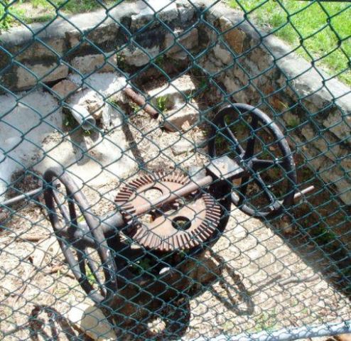
During World War Two, particularly as the conflict spread to the Pacific, Brisbane became a garrison town with the influx of as many as 73,000 United States service personnel from 1942. Most racecourses were taken over for military purposes and the Bulimba and Hamilton reaches of the river became important to air and sea defences. The proximity of the elevated Bartley’s Hill to the river and racecourse encampments made it a logical observation post to contribute to the defence of the city. A 1973 map shows a building near the reservoir to be a ‘wartime shelter’. It is likely that an existing building was converted for wartime purposes, however further detailed research is required to identify the exact nature of wartime activity at the reservoir. Drawings for the re-roofing of the reservoirs were prepared in 1973.
Statement of significance
Relevant assessment criteria
This is a place of local heritage significance and meets one or more of the local heritage criteria under the Heritage planning scheme policy of the Brisbane City Plan 2014. It is significant because:
References
-
Brisbane City Council, Bartley’s Hill Reservoir, Conservation Management Study, 2002
-
Nolan, Caroline. Brisbane’s North Eastern Suburbs. Our Heritage in Focus. South Brisbane: State Library of Queensland, 1995
Citation prepared by — Brisbane City Council (page revised June 2022)