Addresses
Type of place
Dam / reservoir
Period
Interwar 1919-1939
Style
Queenslander

Eildon Hill Reservoir
Eildon Hill Reservoir
Eildon Hill Reservoir
This is an image of the local heritage place known as Eildon Hill Reservoir 1
This is an image of the local heritage place known as Eildon Hill Reservoir
Eildon Hill Reservoir
Addresses
Type of place
Dam / reservoir
Period
Interwar 1919-1939
Style
Queenslander
Lot plan
L192_RP19870; L193_RP19870; L569_SP298595; L1_SP298595
Key dates
Local Heritage Place Since —
Date of Information —
Construction
StructureCriterion for listing
(A) Historical; (D) Representative; (E) Aesthetic; (G) SocialInteractive mapping
Lot plan
L192_RP19870; L193_RP19870; L569_SP298595; L1_SP298595
Key dates
Local Heritage Place Since —
Date of Information —
Construction
StructureCriterion for listing
(A) Historical; (D) Representative; (E) Aesthetic; (G) SocialInteractive mapping
History
Eildon Hill, with its views from the border ranges to Cunningham's Gap, to the Taylor and d'Aguilar Ranges, and to the islands of Moreton Bay, has a very significant history. Since 1930 the hill has been the site of the Reservoir, which has subsequently become an important component of the water supply system to Windsor and the surrounding districts. Before Europeans claimed the hill, it was reputedly a favoured vantage point for Aboriginal groups. Its slopes were also favoured locations for the European colonists who bought up substantial parcels of land in the vicinity. Both before and since the construction of the Reservoir, Eildon Hill has played a significant part in the lives of the successive generations of Brisbane people, who picnicked on the slopes, who were drawn to the summit as a vantage point, or who used the slopes in their every day pursuits.
The parcels of land which encompass the slopes of the Hill were among the first to be released and bought in the 1858 land sales.
Several noteworthy early residents of the colony, including the Rev. George Wight, Somerset and Neremiah Bartley, were among the early purchasers. Wight not only built his home on the southern slopes but also established a preaching station by 1863, which was attended by many of the early residents of the district. In his words, the location was "just beyond the suburbs". Wight allegedly named the hill after the Eildon Hills near his home in Scotland. According to local folklore, Rougham, the home of the Drury family, once occupied the lower of the two peaks of the hill and the Cock family established a dairy on the western slopes.
The hill was acquired by the Water & Sewerage Board around the turn of the century with the intention of constructing a reservoir. William Jolly, the first mayor of the Greater Brisbane Council, urged the Board to avoid this if possible because of the hill's fine views over the city, arguing that "it should be retained purely for public use and later on beautified".
However, the construction of the reservoir went ahead despite Jolly's protestations. Early in 1929 detailed plans were completed for a Reservoir of 5,380,000 gallon (22 million litres) capacity. A contract was entered into with H. Cheetham in April 1929 to construct the reservoir at a cost of £46, 103/13/6. 35,533 cubic yards of spoil were excavated during 1929 using horses and drays to remove it from the site. The expected completion date was July 1930, however the reservoir was not brought into service until September 1930.
A 24 inch and 12 inch cast iron scour drain under the reservoir, the scour chamber, the 18- inch scour drain from the Reservoir to Drury Street, and the outlet chamber were also constructed at that time. A formal roadway to the top of the hill was also constructed, and elaborate gates and pillars were constructed at the entrance to the site.
The concrete roof was considered to be a radical addition, and at the time of construction it was mooted that the roof could ultimately be used "as a vantage point for obtaining excellent views of the City and its surroundings". A directional dial was placed on the reservoir roof.
A cottage from land resumed by Council during the construction of the Grey Street Bridge, was re-erected at Eildon Hill as a caretaker's residence. The bare site was planted with vegetation after the reservoir was completed and today the hill is covered by dense scrub.
Eildon Hill has continued to be a special place for the local community. The reservoir grounds are publicly accessible to pedestrians and vehicles. ln addition to its continuing use as a water reservoir, Eildon Hill has provided a vantage point to watch fireworks, an unofficial playground for children, a "lovers' lane" for couples and even a setting for wedding photographs. It also provides a much-appreciated oasis of bushland in the midst of suburban Brisbane.
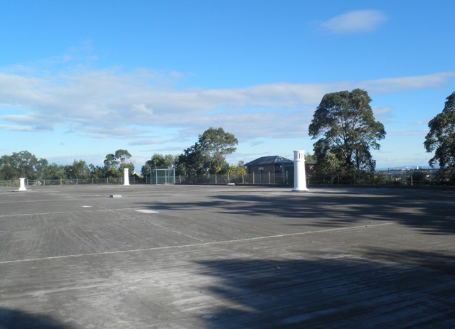
Description
Eildon Hill Reservoir is a functioning, in-ground water storage facility located in a reserve on Eildon Hill. The site is entered via Constitution Road through an imposing entry structure. This comprises a pair of white rendered concrete pillars, iron gates and a short length of white picket fence on either side. Immediately beyond the gates, on the reservoir side of the drive is the former turncock's cottage. The timber house is supported on concrete stumps and features a corrugated iron roof.
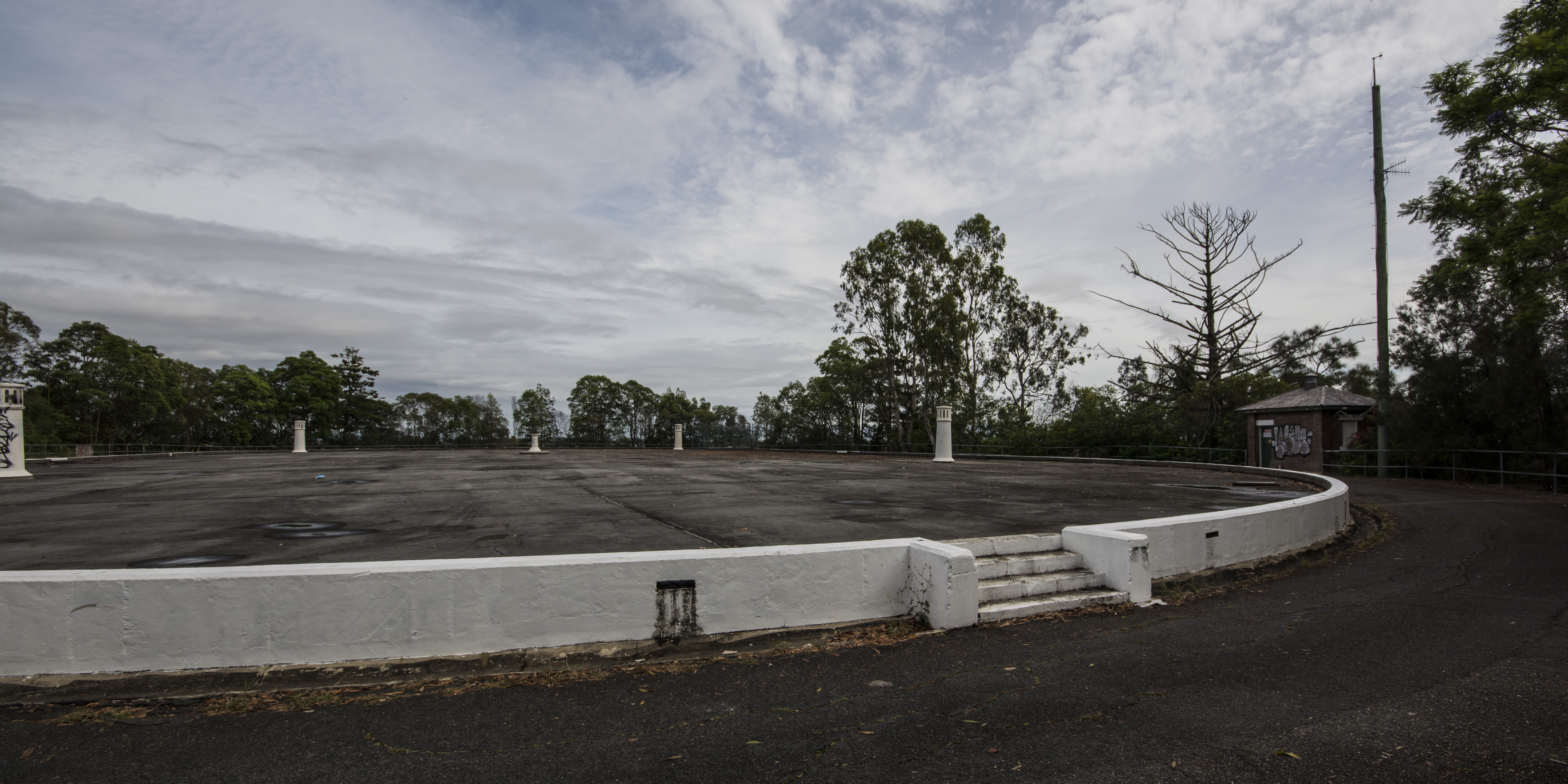
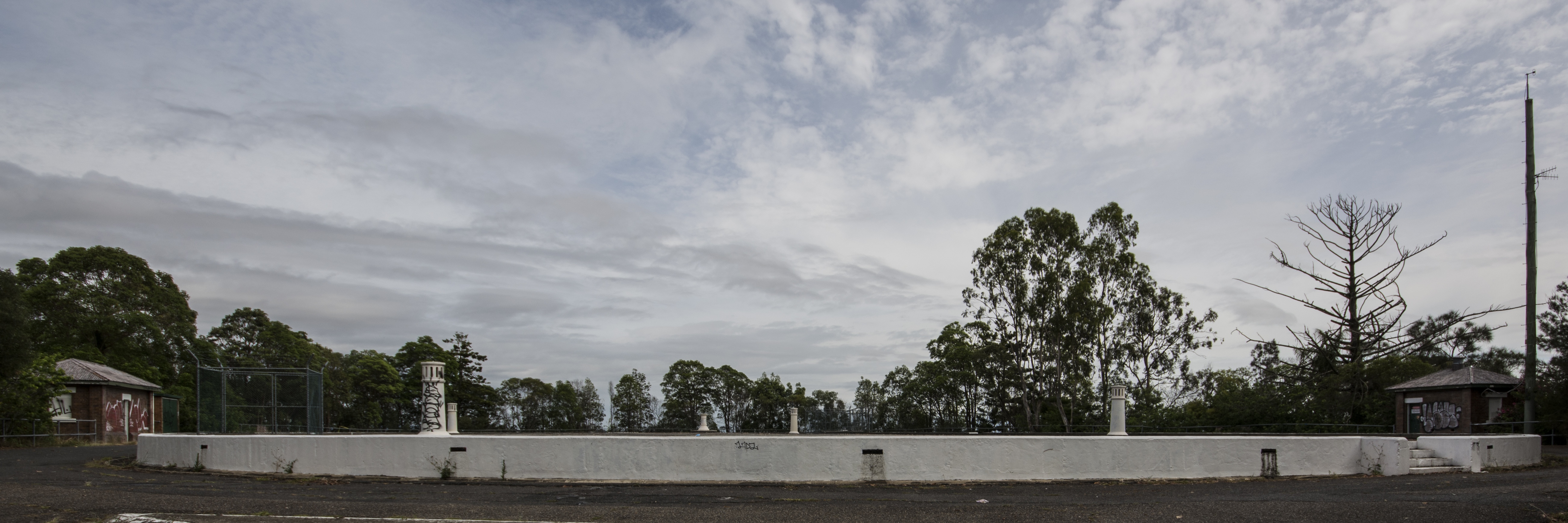
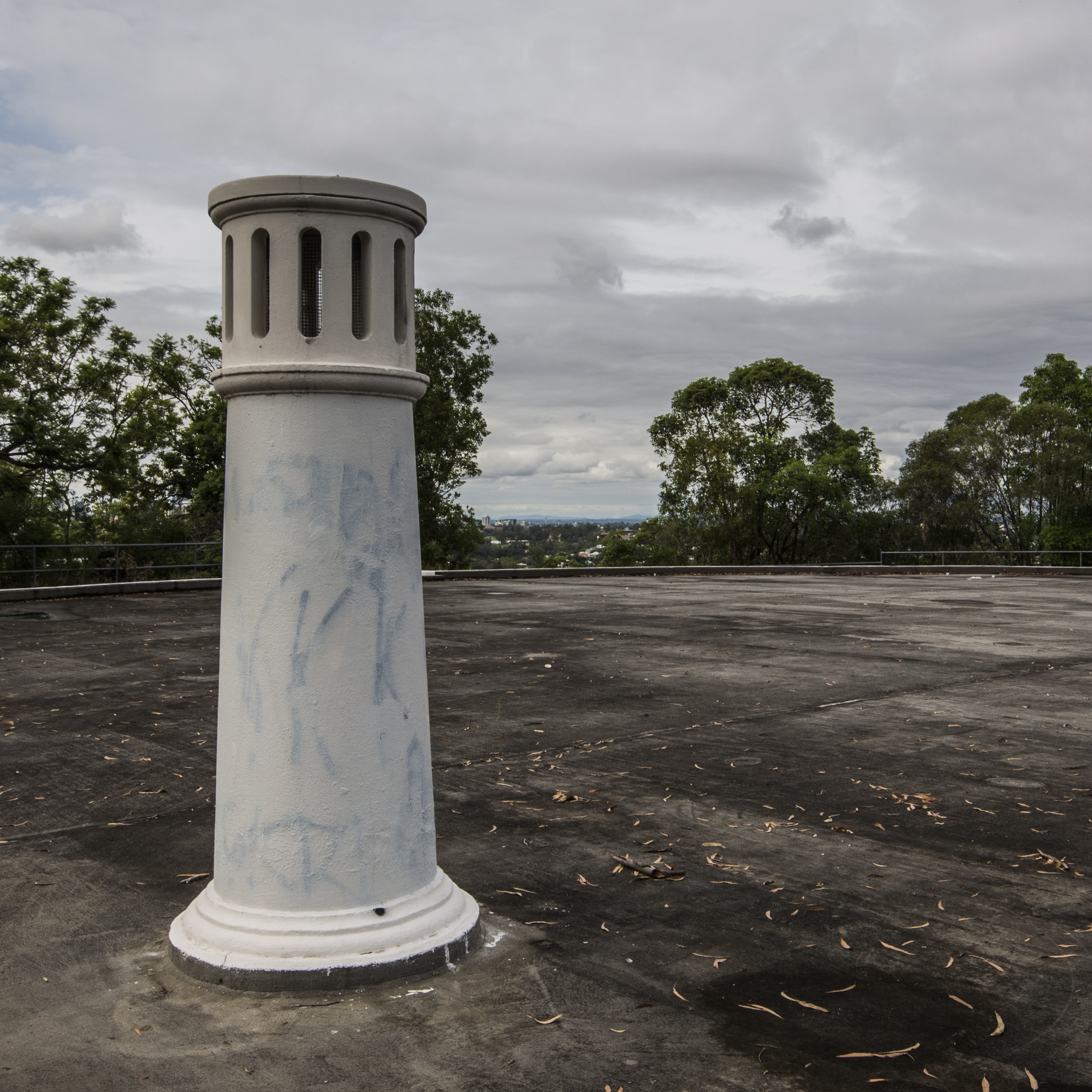
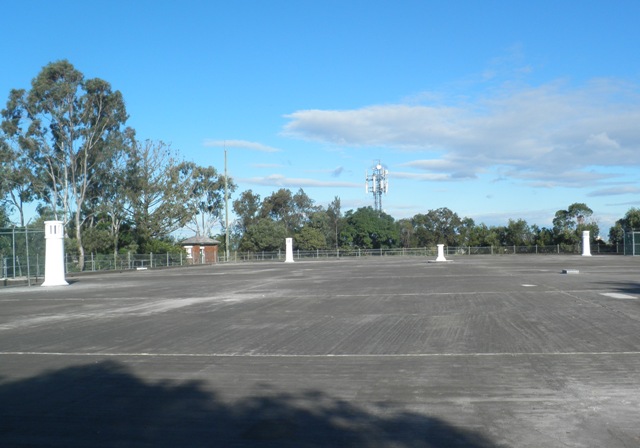
Once past the house, the drive rises in a clockwise direction around the reservoir embankments, until reaching the platform roof level on its southern edge. The elevated site has commanding views in all directions. The reservoir has an oval plan and is surrounded by the publicly accessible vehicular drive. The concrete structure of the reservoir is largely below ground. Its flat concrete roof is trafficable by foot and raised approximately 500mm above the finished ground level. The roof is punctuated by four vents, in form of cast iron pillars, one of which has lost is original slotted capping piece. In the centre of the reservoir is the pedestal for a directional dial. However the dial has been removed after being damaged by vandals.
The other main structures on the reservoir platform are brick valve huts located beside the vehicular drive. The inlet valve huts are on the southwest edge of the drive, while the outlet valve hut is on eastern side. These are simple structures with hipped corrugated iron roofs.
A telecommunications tower and associated equipment are accommodated in a small enclosure near the top of the driveway.
Condition and Integrity of the Site
A brief visual inspection of the reservoir roof reveals it to be in good condition. (Note: the reservoir and other structures were not inspected on the inside). The ancillary buildings also appear to be well-maintained.
There have been few changes to the reservoir structure and valve houses. The whole site is significant, with exemption of the telecommunications structures.
Statement of significance
Relevant assessment criteria
This is a place of local heritage significance and meets one or more of the local heritage criteria under the Heritage planning scheme policy of the Brisbane City Plan 2014. It is significant because:
Citation prepared by — Brisbane City Council (page revised September 2021)