Addresses
Type of place
Roadway
Period
Victorian 1860-1890
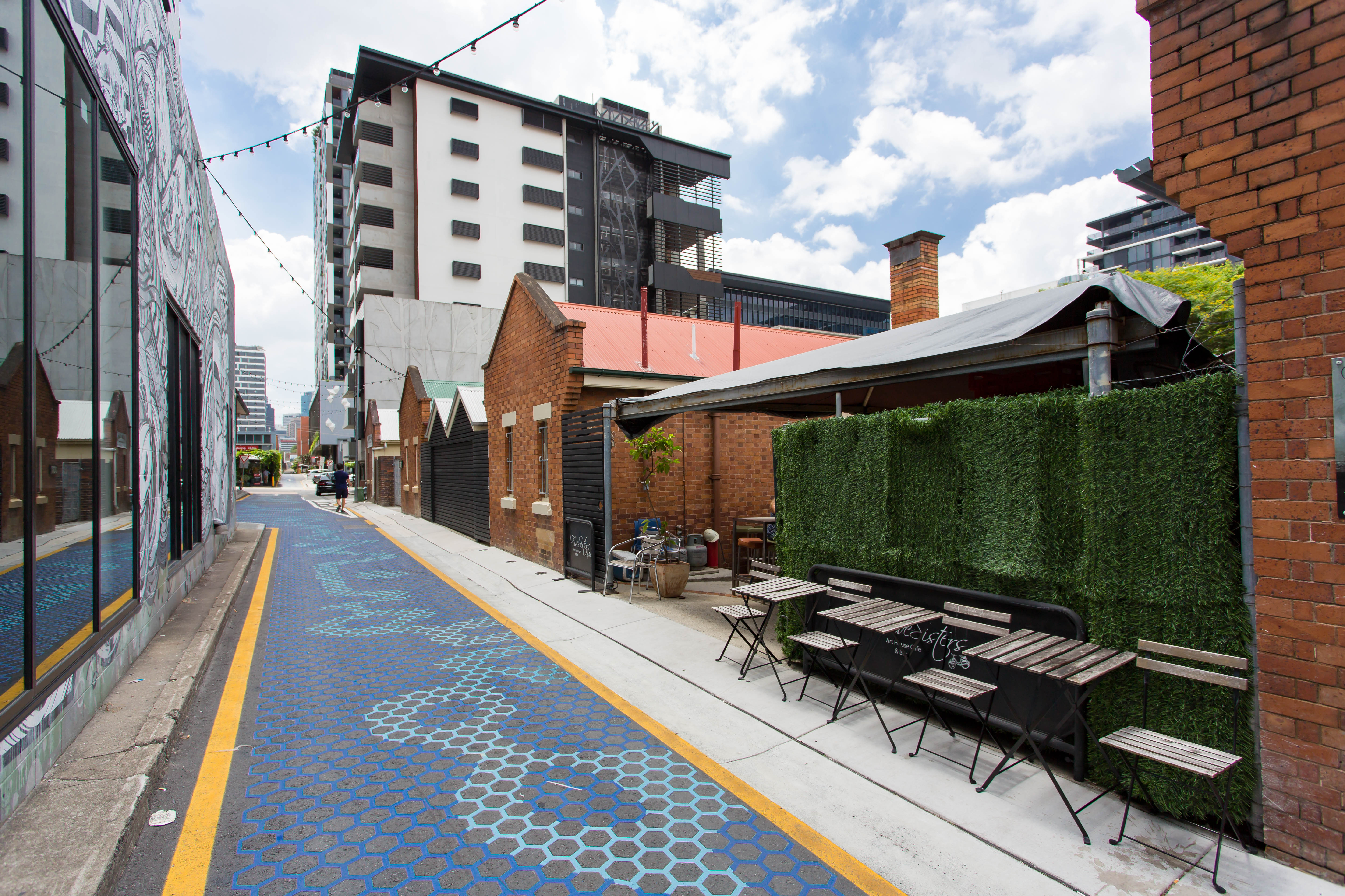

Fish Lane
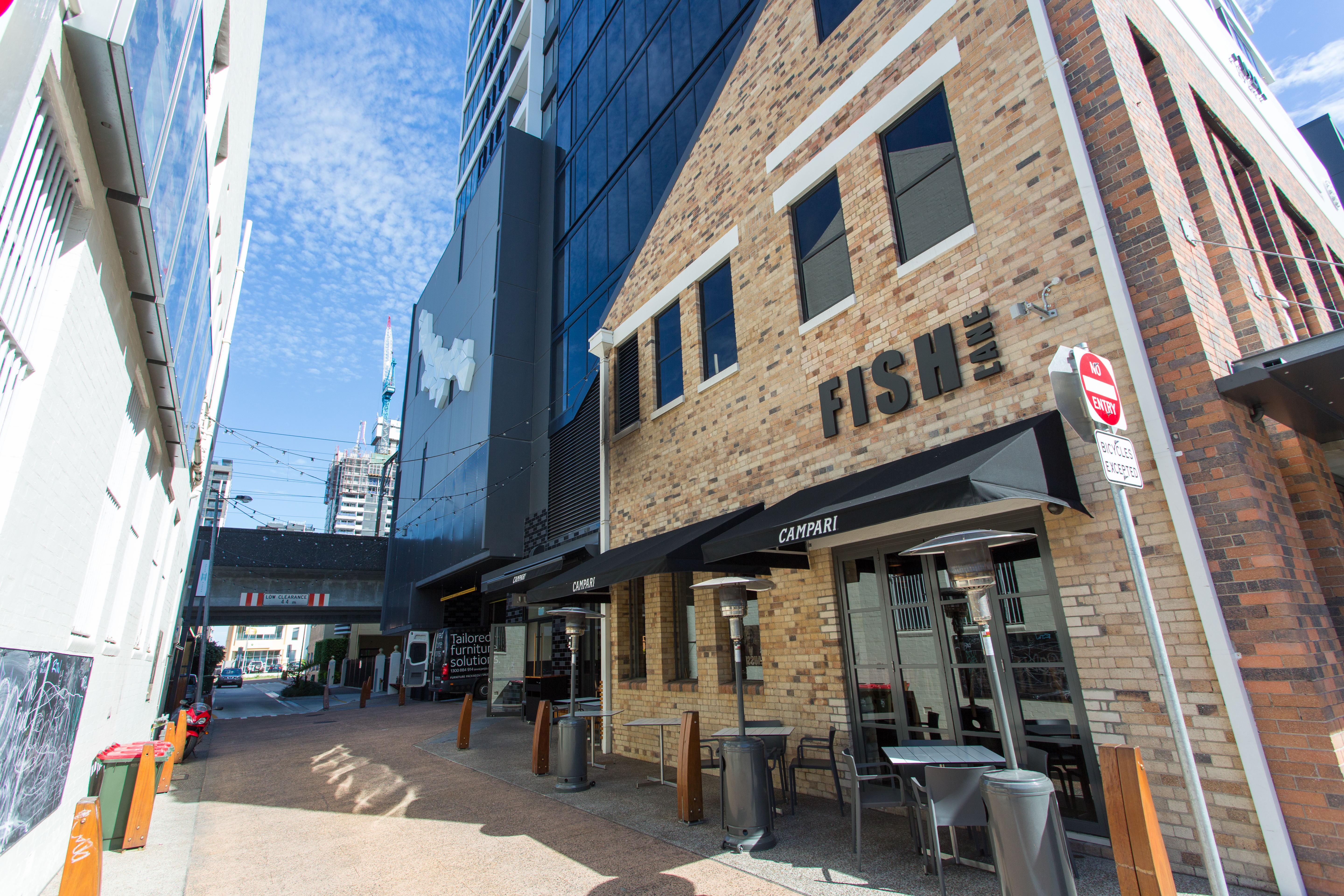
Fish Lane, Eastern End
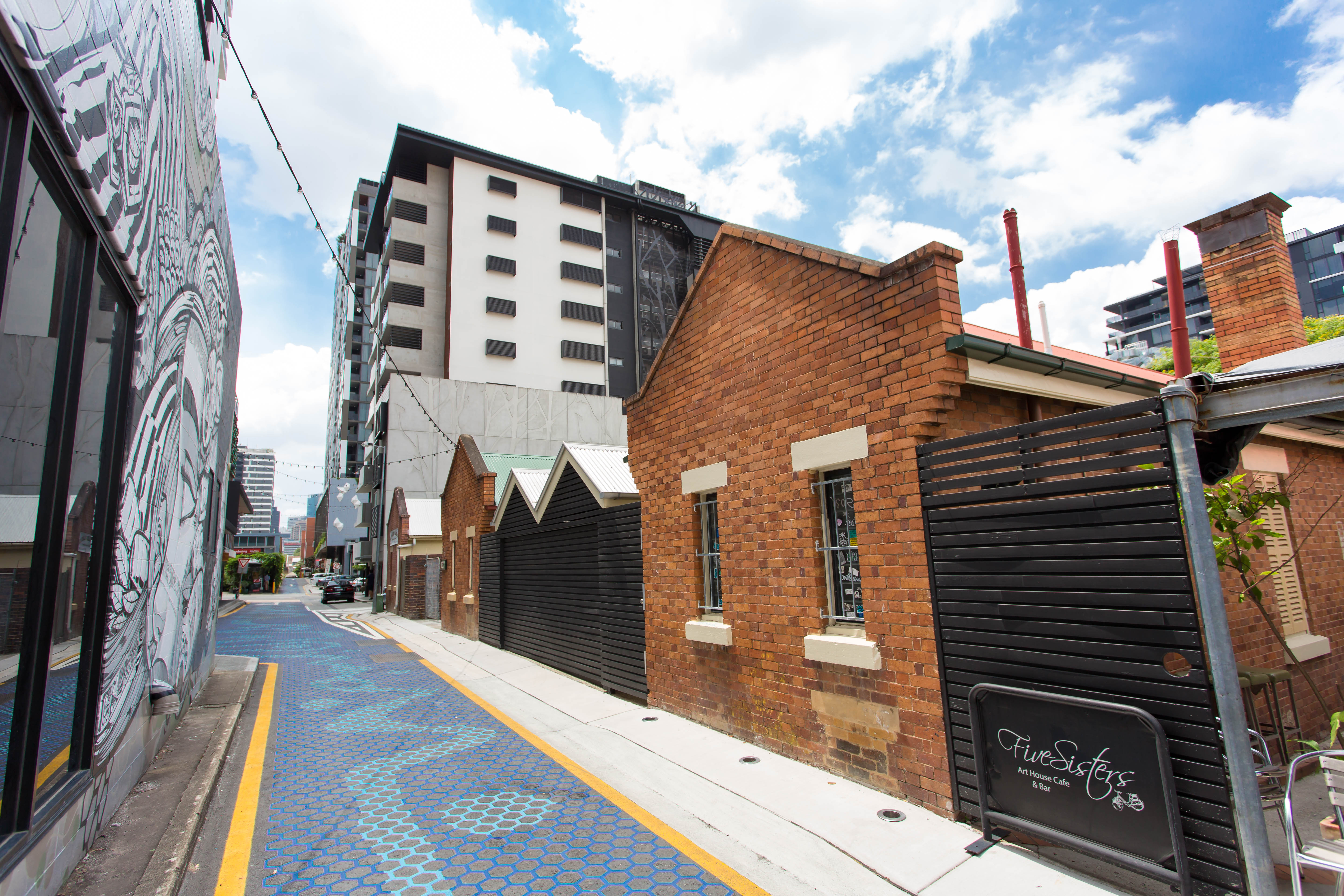
Fish Lane
Fish Lane
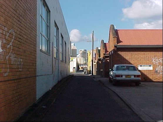
This is an image of the local heritage place known as Fish Lane
Fish Lane
Addresses
Type of place
Roadway
Period
Victorian 1860-1890
Although it existed as an access track from the 1870s, this lane was not gazetted and given the name of Soda Water Lane until 1885. Initially, it extended from Stanley Street through to Grey Street and provided front access for a number of residences plus the Eodone Aerated Water Company and George Fish’s Brisbane Steam Laundry. In 1904, the lane was renamed in honour of George Fish, who was also a prominent local politician. In 1924, Fish Lane was extended through to Manning Street which brought more business into it, and it was upgraded to Street status in 1931. However, the decline in South Brisbane’s commercial centre from the 1950s saw Fish Street revert back to a laneway. With the demolition of much of South Brisbane’s commercial centre for Expo 88, all of the area’s service lanes were lost, with the exception of Fleet Lane and Fish Lane.
Also known as
Soda Water Lane
Geolocation
-27.474977 153.015678
Key dates
Local Heritage Place Since —
Date of Citation —
People/associations
George Fish (Association)Criterion for listing
(A) Historical; (B) Rarity; (H) Historical associationInteractive mapping
Also known as
Soda Water Lane
Geolocation
-27.474977 153.015678
Key dates
Local Heritage Place Since —
Date of Citation —
People/associations
George Fish (Association)Criterion for listing
(A) Historical; (B) Rarity; (H) Historical associationInteractive mapping
History
Fish Lane was originally the rear portion of a school reserve containing 2.5 acres that had been granted to the Church of England in 1851. Initially it only ran from Stanley Street through to Grey Street in South Brisbane and it was known as Soda Water Lane. This name was derived from the Eodone Aerated Water Company that was one of the first occupants of this lane.
According to John McClurg’s Historical Sketches of Brisbane, this company established its cordial factory at Soda Water Lane in the early 1870s. But both Thomas Maughan’s Eodone Aerated Water Company and Soda Water Lane do not appear in the Queensland Post Office Directories until 1885. It is assumed that the lane may have existed as an access track from the 1870s but it was not gazetted as a formal laneway until 1885.
By 1886, there were two residences and one business fronting the lane. Apart from the Eodone Company, there were also lemonade manufacturer Edward Bessell and paint manufacturer and engineer, Benjamin Burlinson. Situated at the corner of Stanley Street and Soda Water Lane was the Brisbane Steam Laundry Company operated by George Fish.
George Fish was a prominent local politician. He was elected as alderman on the South Brisbane Municipal (later City) Council from 1894 to 1907. He served on the Council’s Finance Committee, Municipal Library and Fine Arts Committee, Works Committee and Legislative Committee. In 1904, that Council approved a name change so that Soda Water Lane was renamed Fish Lane in honour of George Fish.
Fish renamed his company the Fish Steam Laundry Pty Ltd.
By 1903, he had moved his business from the lane to premises in Ann Street, Fortitude Valley. By 1905, the Eodone Company had also vacated Fish Lane, leaving only one occupant in the lane, Gordon George. His residence passed to Mrs Hester Ivory in 1908. In 1910, Nicholas Jackman replaced Mrs Ivory as the sole resident of Fish Lane. Jackman continued to live at Fish Lane until 1916, when he transferred his property to William and Mary Walsh. William died in 1918 and his widow Mary continued to live at their house until 1924.
In 1924, the South Brisbane City Council widened Melbourne Street. In conjunction with these roadworks, privately owned land was resumed to allow the extension of Fish Lane across four city blocks. The lane was pushed through from Grey Street and under the South Brisbane railway line to Hope Street, then across to Merivale Street and across Cordelia Street before ending at Manning Street. This project was completed by 1925. Fish Lane became the longest of the twelve lanes that fed service vehicles to the businesses in South Brisbane’s commercial centre. Fish Lane was the only one of these twelve lanes that provided a traffic connection between parallel streets.
As a result of Fish Lane’s extension across five city blocks, a number of small businesses took the opportunity to establish themselves in this part of South Brisbane’s commercial centre. By 1930, the Fuji Laundry, Stacey Brothers sheet metal works, advertising agents Wiliams Advertising Services, machinery merchants Duck Brothers, chair manufacturer A. H. Millard, printer P. Beard, french polisher T. Cockburn, scales representative G.H. Kent, sign painter Tyson Toobey, cabinet maker Blair Kerr and the Bethel Mission had spread themselves along Fish Lane.
By 1931, even more businesses such as Mrs Stansil Maina’s cleaning and dyeing works had moved into Fish Lane. Fish Lane was no longer just a service road for the properties fronting Melbourne Street but was a long and busy thoroughfare allowing main access to numerous businesses. Thus the Brisbane City Council decided in 1931 to upgrade Fish Lane to the status of a street. Fish Lane was renamed Fish Street and it was known as such until sometime after 1949.
In the postwar period, the number of businesses operating out of Fish Street declined. This was a reflection of the gradual demise of South Brisbane’s importance as a commercial centre. By 1949, there were only a few businesses, such as the Stage Door Café and the Brisbane Laundry, continuing to operate out of Fish Street.
From the 1950s through to the 1970s, South Brisbane became a run-down, economically stagnant part of Brisbane. During this period, Fish Street reverted to being called Fish Lane and it was used as a service entrance for those businesses such as the Terminus Hotel that were operating along Melbourne Street.
In 1988, the South Brisbane area underwent a major redevelopment as it was chosen as the site for World Expo 88. Not only were many of the old buildings along Stanley Street demolished to make way for the Expo site but also nearly all of the service laneways from the old South Brisbane commercial district were removed to provide more space for the venue. One of the casualties of the Expo redevelopment was the original 1870s portion of Fish Lane that ran between Stanley and Grey Streets. Thus Fish Lane, together with Fleet Lane, are the only surviving service routes left from the twelve lanes that were once an important part of the streetscape of South Brisbane’s commercial hub.
Description
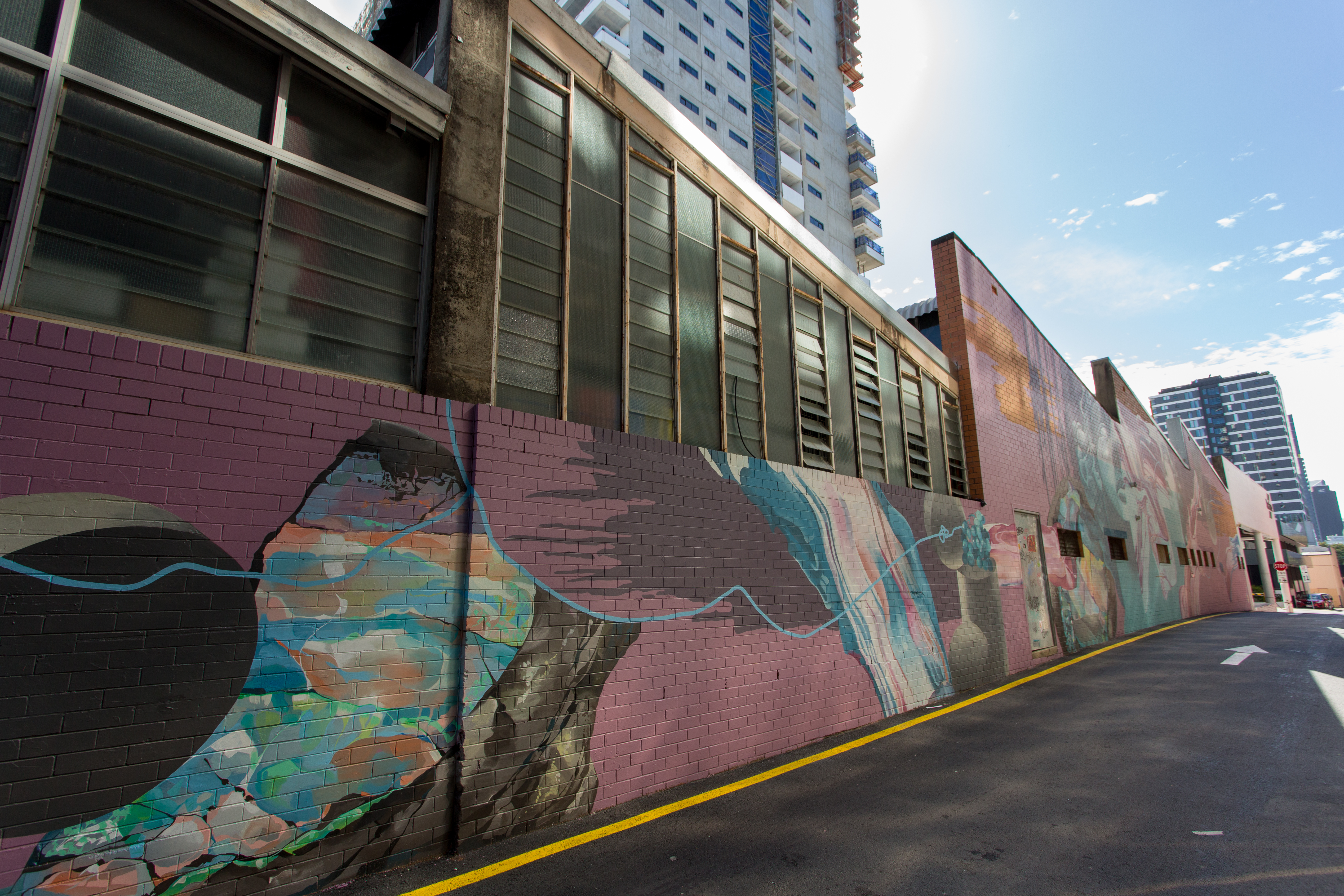
Fish Lane is a long and fairly narrow strip of flat road parallel to Melbourne street in South Brisbane. It functions as a service lane and is also commonly used as a pedestrian thoroughfare. The lane intersects with three roads (Cordelia, Merivale and Hope Street) over four blocks of built land between Manning Street and Grey Street.
The nature of the buildings abutting the lane-way adds to the character of the space. The rear of most of the buildings are of face brick, some have rendered lintels and sills with pitched corrugated iron roofs and sun hoods. Glimpses of timber escape stairs situated behind the Corio and Merivale Flats and remnants of the loading bay that serviced the back of the commercial building at 27 Cordelia Street, demonstrate the historical development of the lane.
Statement of significance
Relevant assessment criteria
This is a place of local heritage significance and meets one or more of the local heritage criteria under the Heritage planning scheme policy of the Brisbane City Plan 2014. It is significant because:
References
-
Brisbane City Council Water Supply and Sewerage Detail Plans
-
Brisbane City Council, 1946 aerial photographs.
-
Brisbane City Council Art Gallery, Mayors, Lord Mayors – Alderman (1859-1994)
-
Department of Natural Resources, Queensland Certificates of title and other records.
-
Lawson, Ronald Brisbane in the 1890s: A Study of an Australian Urban Society. St Lucia U of Q Press, 1973
-
McClurg, John. H.C. Historical Sketches of Brisbane. (Brisbane, Library Board of Qld & Royal Historical Society of Qld.1975)
-
McKellar's Map of Brisbane and Suburbs. Brisbane: Surveyor-General’s Office, 1895
Citation prepared by — Brisbane City Council (page revised September 2020)