Address summary
94, 98 and 102 Alexandra Rd, Ascot; 92 Alexandra Rd, Clayfield; 19 Craven St, Clayfield; 24, 26, 32, 40, 52, 57, 58, 60, 63, 64, 67, 71, 72, 77 and 82 Enderley Rd, Clayfield
Addresses
- At 72 Enderley Road, Clayfield, Queensland 4011;
- At 94 Alexandra Road, Ascot, Queensland 4010;
- At 98 Alexandra Road, Ascot, Queensland 4010;
- At 102 Alexandra Road, Ascot, Queensland 4010;
- At 92 Alexandra Road, Clayfield, Queensland 4011;
- At 19 Craven Street, Clayfield, Queensland 4011;
- At 24 Enderley Road, Clayfield, Queensland 4011;
- At 26 Enderley Road, Clayfield, Queensland 4011;
- At 32 Enderley Road, Clayfield, Queensland 4011;
- At 40 Enderley Road, Clayfield, Queensland 4011;
- At 52 Enderley Road, Clayfield, Queensland 4011;
- At 57 Enderley Road, Clayfield, Queensland 4011;
- At 58 Enderley Road, Clayfield, Queensland 4011;
- At 60 Enderley Road, Clayfield, Queensland 4011;
- At 63 Enderley Road, Clayfield, Queensland 4011;
- At 64 Enderley Road, Clayfield, Queensland 4011;
- At 67 Enderley Road, Clayfield, Queensland 4011;
- At 71 Enderley Road, Clayfield, Queensland 4011;
- At 72 Enderley Road, Clayfield, Queensland 4011;
- At 77 Enderley Road, Clayfield, Queensland 4011;
- At 82 Enderley Road, Clayfield, Queensland 4011
Type of place
House, Urban precinct
Period
Federation 1890-1914, World War I 1914-1918, Interwar 1919-1939
Style
California Bungalow, Free Classical, Old English, Queen Anne, Spanish Mission
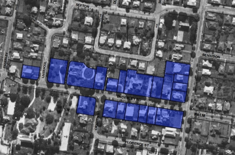

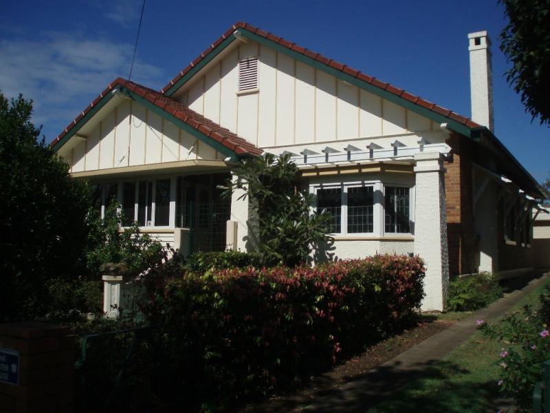
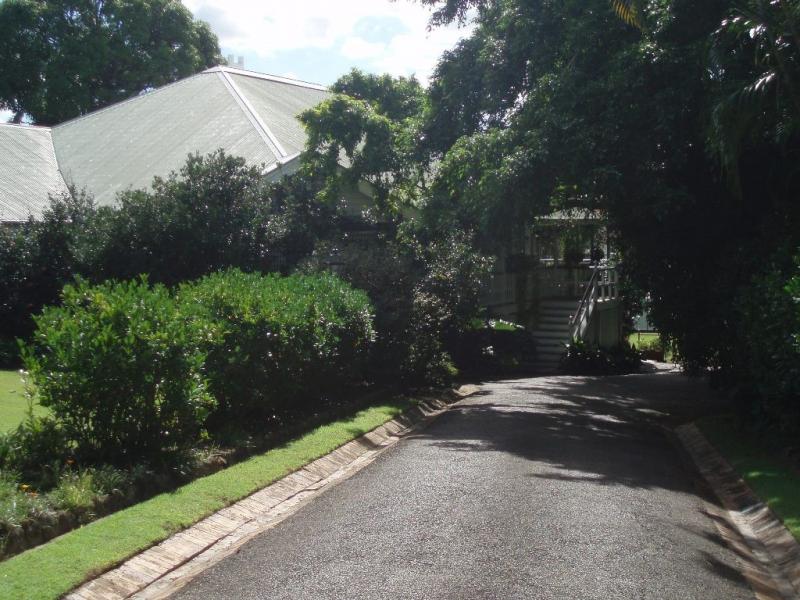
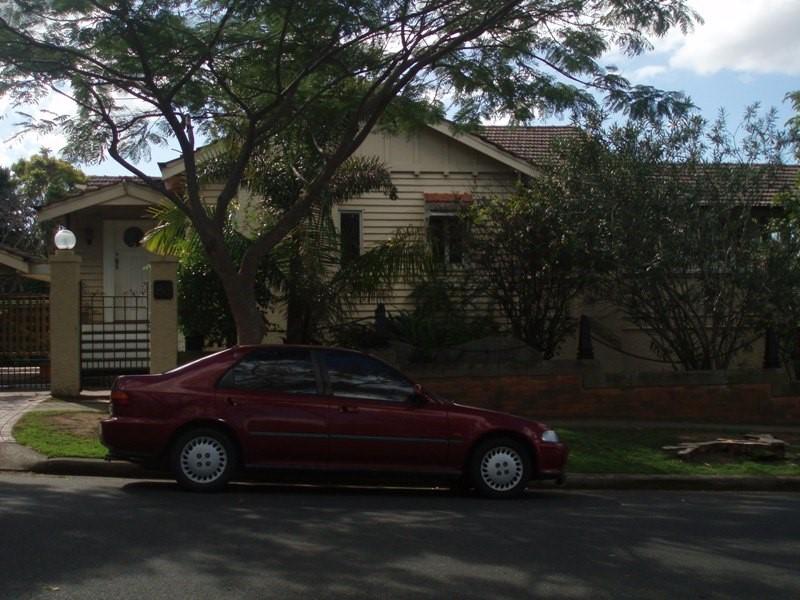
This is an image of the local heritage place known as Enderley Road Heritage Precinct 1
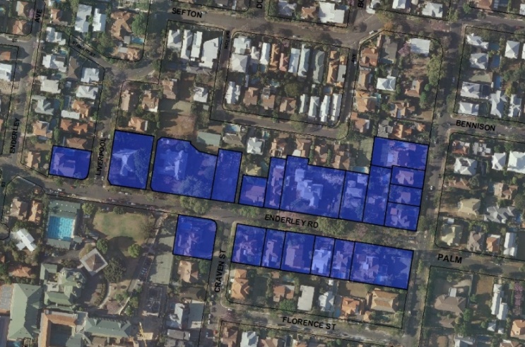
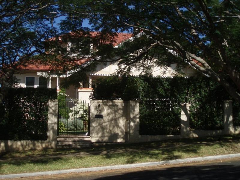
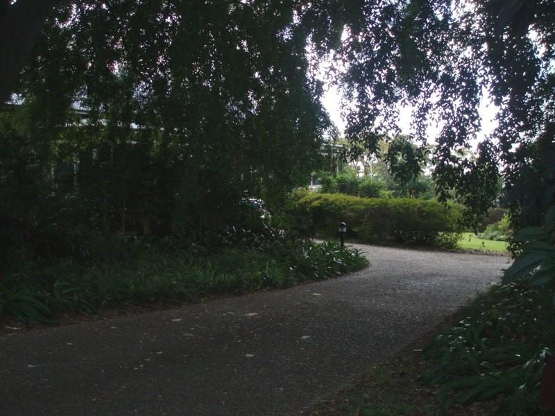
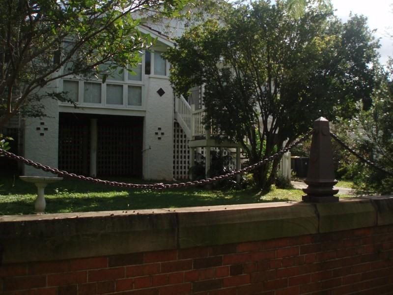
This is an image of the local heritage place known as Enderley Road Heritage Precinct 2
Enderley Road Heritage Precinct
Address summary
94, 98 and 102 Alexandra Rd, Ascot; 92 Alexandra Rd, Clayfield; 19 Craven St, Clayfield; 24, 26, 32, 40, 52, 57, 58, 60, 63, 64, 67, 71, 72, 77 and 82 Enderley Rd, Clayfield
Addresses
- At 72 Enderley Road, Clayfield, Queensland 4011;
- At 94 Alexandra Road, Ascot, Queensland 4010;
- At 98 Alexandra Road, Ascot, Queensland 4010;
- At 102 Alexandra Road, Ascot, Queensland 4010;
- At 92 Alexandra Road, Clayfield, Queensland 4011;
- At 19 Craven Street, Clayfield, Queensland 4011;
- At 24 Enderley Road, Clayfield, Queensland 4011;
- At 26 Enderley Road, Clayfield, Queensland 4011;
- At 32 Enderley Road, Clayfield, Queensland 4011;
- At 40 Enderley Road, Clayfield, Queensland 4011;
- At 52 Enderley Road, Clayfield, Queensland 4011;
- At 57 Enderley Road, Clayfield, Queensland 4011;
- At 58 Enderley Road, Clayfield, Queensland 4011;
- At 60 Enderley Road, Clayfield, Queensland 4011;
- At 63 Enderley Road, Clayfield, Queensland 4011;
- At 64 Enderley Road, Clayfield, Queensland 4011;
- At 67 Enderley Road, Clayfield, Queensland 4011;
- At 71 Enderley Road, Clayfield, Queensland 4011;
- At 72 Enderley Road, Clayfield, Queensland 4011;
- At 77 Enderley Road, Clayfield, Queensland 4011;
- At 82 Enderley Road, Clayfield, Queensland 4011
Type of place
House, Urban precinct
Period
Federation 1890-1914, World War I 1914-1918, Interwar 1919-1939
Style
California Bungalow, Free Classical, Old English, Queen Anne, Spanish Mission
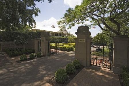
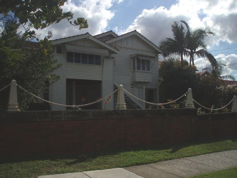
The Enderley Road precinct encapsulates many of the Clayfield area’s special characteristics – large, detached, often architect designed houses dating from the late 19th century to the Interwar period, generously sized subdivision patterns and mature street plantings. As a street in one of the city’s more sought after suburbs, many of its residents have been influential in Brisbane’s business and professional circles. From the 1880s, these families established homes which reflected their socio-economic standing in the community and, today, provide evidence of a former way of life – for example, surviving servants’ accommodation and circular carriage drives.
Lot plan
Geolocation
-27.425041 153.057744
Key dates
Local Heritage Place Since —
Criterion for listing
(A) Historical; (D) Representative; (E) Aesthetic; (H) Historical associationInteractive mapping
Lot plan
Geolocation
-27.425041 153.057744
Key dates
Local Heritage Place Since —
Criterion for listing
(A) Historical; (D) Representative; (E) Aesthetic; (H) Historical associationInteractive mapping
History
Land in the Enderley Road area was first purchased by Deed of Grant in the 1850s. The original large portions were subdivided and sold several times before farms and rural estates were established from around the 1880s. Elsewhere in the Clayfield/Albion area, pineapple and dairy farms were established as well as some industry, such as Petrie’s Brickworks on Oriel Road and Campbell’s Brickworks and Petrie’s Quarry on Crosby Road (then named Gaythorne Road). There were several grand houses on large estates built from the 1870s such as Whytecliffe (1875-76) on Sandgate Road at Albion, Tarranalma (1880s-90s) on the hill above Sandgate Road at Clayfield, and Mooloomburrum (1886) built for Andrew Petrie on what is now the site of St Margaret’s School.
By the late 19th century, Enderley Road was still a semi-rural retreat for a handful of families. Two grand residences were built in the street in the 1880s – the ornate Stanley Hall built for John Forth on 12 acres on the southern side of the street and Huntington built for Robert Gray on eight acres on the northern side. Liddleton, the property of Francis Spence, occupied five acres at the corner of Enderley Road and Franz Road (now Alexandra Road). This house, which apparently addressed Alexandra Road has not survived in situ.
At the beginning of the twentieth century, Enderley Road terminated at the western end close to where St Rita’s College is now. Beyond this point, on the slope of Beaufort Hill, was the McDiarmids’ farm of nine acres, known as Enderley. Further to the west was another elite residence on a large estate, Beaufort Hill (built 1896). The McDiarmids’ farm was sold to the Charlton family in 1900 and the forested land on the northern part of the farm reportedly cleared by Kanaka labour. The Charltons added to the existing farmhouse and renamed it Fortland.
By 1906, there was still only four properties noted in Enderley Road: Matthew Laird at Huntington, J.B. Charlton at Fortland (demolished in the 1950s), Montague Talbot Stanley at Stanwraith (now 32 Enderley Rd), and Herbert Hunter at Stanley Hall. The son of JB Charlton, Frank Charlton, described Enderley Road as “the old three track style…the twoMoutside tracks were made by the vehicle wheels and the centre track made by the horse”.1 The Charltons later donated the land which enabled Enderley Road to be extended to meet Crombie Street at the top of the hill in the late 1910s/early 1920s.
The 1920s brought change and a second wave of residential development to Enderley Road. Edward Blume subdivided most of the Stanley Hall estate and in 1926, Stanley Hall was sold to the Sisters of the Presentation in Queensland who established St Rita’s Convent School on the site. By 1924, Liverpool Road had been extended to Enderley Road, and Enderley Avenue and Craven Street had been built. The dirt track between J.B. Charlton’s home, Fortland, and his son’s home, Glyngarth, later became the culdersac of Apex Street. (Note: these sites are not within the precinct boundary) The Charlton’s “back paddock” eventually became the tennis courts for St Agatha’s Catholic School. (Note: although Stanley Hall in the grounds of St Rita’s College is on the BCC City Plan Heritage Register, the Enderley Road frontage of this property has been excluded from the precinct for aesthetic reasons).
Between 1923 and 1930, houses in the latest Interwar styles began to appear in the street such as the Spanish Mission home, Breffney on the corner of Enderley and Alexandra Roads, and the Mock Tudor house on the corner of Enderley Road and Craven Street. Part of the Nobles’ six acre property of Linstarfield, built in 1916 on what was previously Francis Spence’s land, was subdivided and gabled timber houses were built behind the former Linstarfield boundary wall along Enderley and Alexandra Roads. As part of this subdivision, Sefton Avenue was created behind Linstarfield where the Nobles’stables used to be. A private school, Sellwood, allegedly built by the Nobles has survived in Sefton Avenue and is now a private home.
Despite these changes, Enderley Road continued to be a quiet street of gracious homes set amongst generous gardens and the residents continued to be drawn from Brisbane’s successful professional and business classes. Photographs of the fashionable new homes in the street featured in the pictorial sections of the newpapers on several occasions.
At the top of Enderley Road where it joins Crombie Street, a large Hills fig tree (Ficus microcarpa var. hillii) stands beside a public stairway which leads down to Beaufort Lane. The staircase dates from at least the early 1930s and is a reminder of the era when few families owned cars and many local journeys were made on foot.
World War II appears to have had little physical impact on the street, apart from the construction of what is believed to be a private air raid shelter in the grounds of Linstarfield.
There has been relatively little change in the street since the 1940s although the site of St Rita’s College has continued to develop into a modern educational facility. Only four post-World War II homes have been built in Enderley Road. The modern house at no. 72 Enderley Road was built in the 1960s when the grounds of Linstarfield were further subdivided to allow family members to build a house on an adjacent lot. This has been a recurring pattern in the history of Enderley Road with second generations often establishing or buying homes in the street.
The street trees in Enderley Road, which include both mature and replacement jacaranda and poinciana trees, provide shade and privacy for the homes that line the street and greatly add to the visual appeal of the precinct. According to the Charlton family, JB Charlton was responsible for the planting of some of these trees as a councillor of the Hamilton Shire/Town Council. JB Charlton served as a councillor from 1902 to 1911 and from 1914 to 1918. He was Mayor of Hamilton Town Council in 1904. Other mature trees which contribute to the aesthetic values of the street include those to be found in the grounds of 32 Enderley Rd and Ralahyne at 40 Enderley Rd.
Enderley Road and the surrounding streets are highly valued by the local residents of Clayfield/Ascot and by the wider Brisbane community for their historical and aesthetic values. The historical development of Enderley Road (and the associated houses in Alexandra Rd) has resulted in a precinct which is significant for its fine examples of historical architectural styles, the contribution of the precinct’s subdivision pattern to our understanding of the historical development of the suburb and its association with several notable local residents and prominent Brisbane architects.
Description
GENERAL DESCRIPTION
The precinct encompasses the majority of the eastern end of Enderley Road, Clayfield and four properties in Alexandra Road, three of which fall within the suburb boundary of Ascot. It contains several properties already entered on the BCC City Plan Heritage Register. A total of 21 properties are included in the precinct. (See attached image for further details).
The precinct is in an area known for its heritage values and large lot subdivision pattern. It contains good examples of a range of detached housing styles, including late 19th/early 20th century traditional timber homes and several excellent examples of Interwar styles including Spanish Mission, Californian Bungalow and Tudor Revival. While some houses have been altered and/or added to, the majority appear from the street to be substantially intact.
The historic streetscape of Enderley Road is enhanced by the established trees and gardens in the grounds of several properties, a variety of boundary walls, and the mature street trees. The street trees include several jacarandas (Jacaranda mimosifolia) and poincianas (Delonix regia). Of the trees in the entire length of Enderley Road, six of the jacarandas appear to be from the original plantings as do 11 of the poincianas. The balance are replacement plantings of varying ages. The eastern side of Craven Street contains 2 replacement poincianas and 2 tulipwoods (Harpullia pendula).
The portion of Alexandra Road included in the precinct includes poinciana trees on the footpath on the western side and three outstanding bumpy ash (Flindersia schottiana) on the eastern side.
INDIVIDUAL DESCRIPTIONS
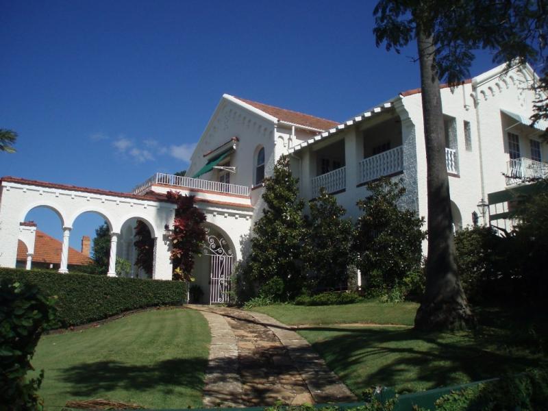
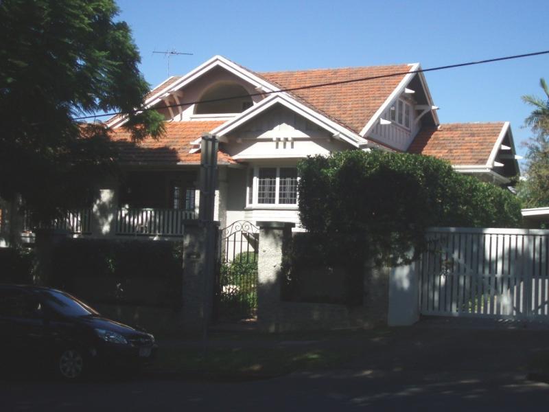
Breffney/Stirling, 83 Enderley Rd, Clayfield (2 428m²)
• Substantial Spanish Mission house built c 1928-29 for Mr and Mrs Hendry Drew
• Designed by influential Brisbane architects Hall and Prentice.
• Grounds include tennis court, tropical plantings, pool (1952), original stucco garage.
• ENTERED ON LHPO AND REGISTER OF NATIONAL ESTATE
Bilboa, 77 Enderley Rd, Clayfield (809m²)
• Two storey timber residence with terracotta tiled roof and fine detailing
• Built circa 1924 for Mrs W. Raff
• Designed by influential Brisbane architect, EP Trewern
• INDIVIDUAL HERITAGE PLACE WITHIN HERITAGE PRECINCT
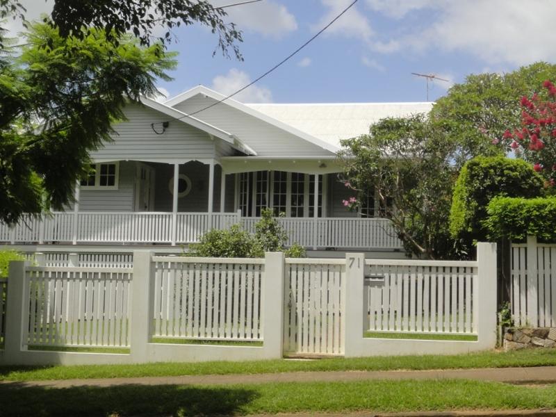
Girrawheen, 71 Enderley Rd, Clayfield (809m²)
• Highset traditional Interwar timber home.
• Built c 1923 for James Milne (occupation ‘manager’).
• Home of Sir Walter Campbell, Chief Justice, from mid 1950s until 1985 when appointed Governor of Queensland.
• Alterations carried out 2010.
• INDIVIDUAL HERITAGE PLACE WITHIN HERITAGE PRECINCT
67 Enderley Rd, Clayfield (1214 m²)
• Highset timber home with terracotta tiled roof.
• Built c 1923 for McMasters.
• Has been enclosed underneath with garage and timber battens.
• PLACE WHICH IS INTEGRAL TO HERITAGE PRECINCT
63 Enderley Rd, Clayfield (809m²)
• Timber gabled bungalow with roughcast masonry piers and terracotta tiled roof
• Built c 1923 for Mrs AM Lennon
• 2008 patio added to rear. 1999 addition to rear.
• PLACE WHICH IS INTEGRAL TO HERITAGE PRECINCT
Fetlar, 57 Enderley Rd, Clayfield (1214 m²)
• Rendered masonry Californian bungalow with roughcast rendered piers, wide front gable, and terracotta tiled roof
• Built c 1923 for Mr Richard Baxter, a wool expert, and his wife, Leila.
• Designed by Chambers and Ford
• INDIVIDUAL HERITAGE PLACE WITHIN PRECINCT
Delcotta, 19 Craven St, (was 51 Enderley Rd) (1645 m²)
• Fine example of Mock Tudor residence designed by influential Brisbane architect, EP Trewern
• Built c 1929-30 for Mr A. Ure McNaught, a dentist, and his wife
• Large extension in same style on southern side of house.
• Currently excluded from DCP which covers the rest of Enderley Rd
• INDIVIDUAL HERITAGE PLACE WITHIN HERITAGE PRECINCT.
Camara, 24 Enderley Rd, Clayfield (8033m²) and adjoining vacant lot 26 Enderley Rd (401m²)
• Elegant timber house with tiled roof and unusual curved front verandah.
• Built c 1927 for Cecil Bowerman, a draper, at an estimated cost of £2 300.
• Original stairs located in centre of curved verandah have been replaced with stairs on side of house.
• Former front garden is now a separate lot (26 Enderley Rd) in different ownership but provides important visual and historical context for no.24 and wider precinct.
• PLACE WHICH IS INTEGRAL TO HERITAGE PRECINCT. (BOTH LOTS 1 & 2).
32 Enderley Rd, Clayfield (2 238m²)
• Large timber residence set in generous grounds – faces east towards Ralahyne
• Built c 1901-02 as Stanwraith, the home of Brisbane architect Montague Talbot Stanley and his wife, Mary (nee McIlwraith – daughter of Sir Thomas McIlwraith, former Premier of Qld).
• Changes include extension of verandah towards Enderley Rd, addition of bathroom onto verandah, enclosed underneath.
• Garden contains several mature trees, including 2 mango trees (Mangifera indica,) 2 jacarandas (Jacaranda mimosifolia), a weeping fig (Ficus benjamina) and a black bean (Castanospermum australe).
• PLACE WHICH IS INTEGRAL TO HERITAGE PRECINCT
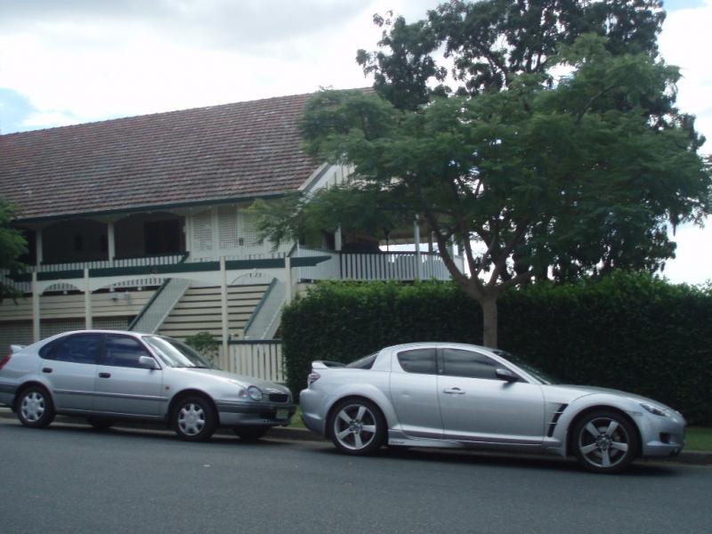
Ralahyne, 40 Enderley Rd, Clayfield (3 331m²)
• Built 1888 for Robert Gray, Under Colonial Secretary, on his 8 acre property
• Single storey timber residence with iron roof
• Designed by GMH Addison
• 1904 extensions by Robin Dods (Hall and Dods)
• Former names East View, Huntingdon, Kujarewon
• Two magnificent landmark weeping fig trees (Ficus benjamina) on either side of entrance estimated to be over a century old.
• ENTERED ON QHR (600182) AND LHPO (since 2000)
52 Enderley Rd, Clayfield (1 277 m²)
• Built c 1926 for George Johnson soon after he purchased 1 rood 37 perches in Enderley Rd.
• Concrete house with tiled roof built at considerable sum of £3 151.
• Builder was George Heaven of Coorparoo.
• Original house has been extended on eastern side and at rear.
• Recent alterations to front garage, addition of terrace landscaping.
• PLACE WHICH IS INTEGRAL TO HERITAGE PRECINCT
Lynton, 58 Enderley Rd, Clayfield (835 m²)
• Highset timber residence constructed c 1918 for Gilbert Lees who acquired a little over three quarters of an acre from the estate of Ralahyne in June 1918.
• Originally had latticework enclosing understorey and tennis court in large rear. garden – since subdivided and new house built on battleaxe block c 1950s.
• Alterations 2004, including replacing tile roof with colorbond.
• PLACE WHICH IS INTEGRAL TO HERITAGE PRECINCT
60 Enderley Rd, Clayfield (794 m²)
• Lowset brick home built 1949 for M. Kristofferson
• Alterations/extensions 2003
• DOES NOT CONTRIBUTE TO HERITAGE PRECINCT
• LOT SIZE AND FUTURE DEVELOPMENT REGULATED BY HERITAGE CODE.
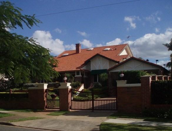
Linstarfield, 64 Enderley Rd, Clayfield (3 101m²)
• Federation style timber villa built for PD Rylance, mine owner, circa 1916
• Attributed to architect TR Hall
• Home of HG Noble from 1918 – built stone and brick wall which now extends east along Enderley Road and north to 102 Alexandra Road.
• Property includes former servants’ quarters on western boundary.
• House has been altered eg former billiard room demolished.
• Further alterations/additions to western and northern sides 2009.
• Large weeping fig tree located on left hand side of driveway and attractive mature Poinciana within the property.
• ENTERED ON LHPO 1 JULY 2009
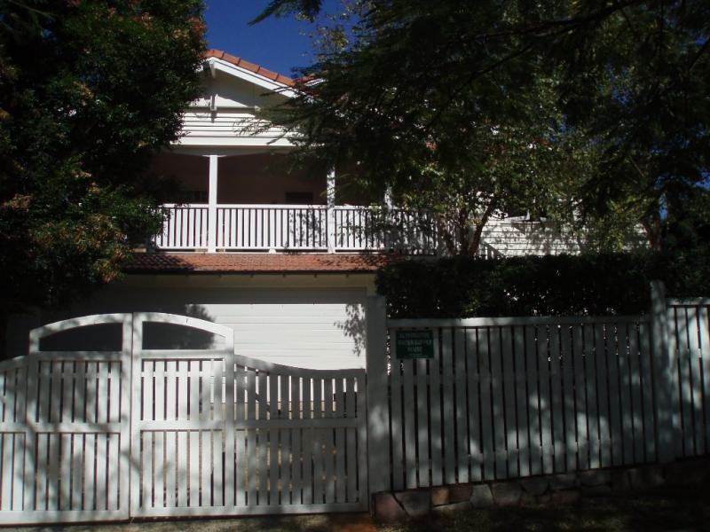
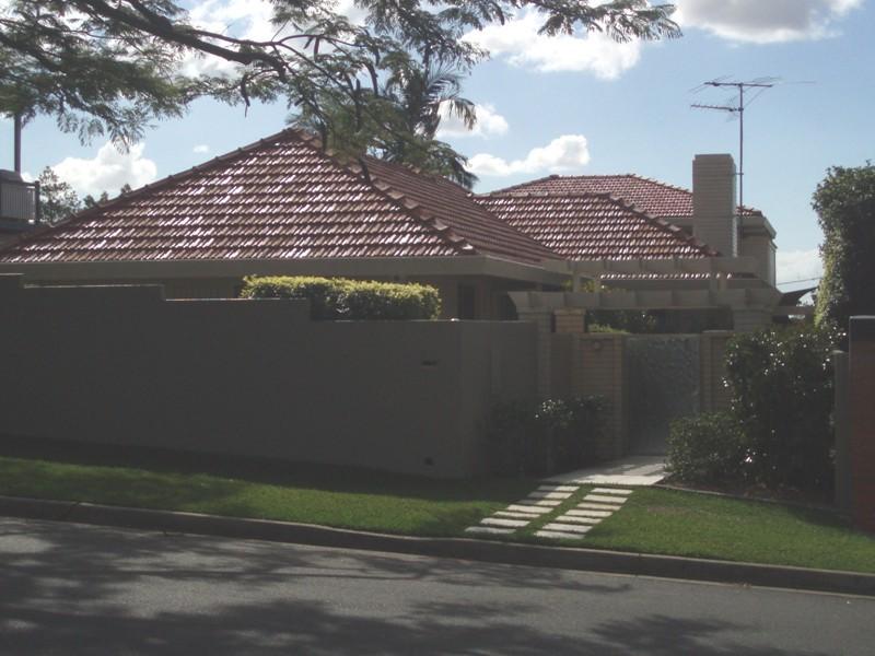
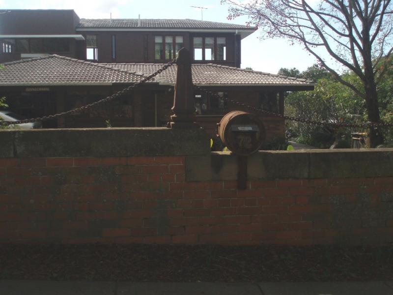
72 Enderley Rd, Clayfield (1 123 m²)
• Modern brick home built 1968-69 for Mr and Mrs Taylor (daughter of former owners of neighbouring Linstarfield).
• Designed by architect, Michael Rees, and inspired by architecture of Frank Lloyd Wright
• 2009 first floor additions – Derek Tribilco
• Property includes former Linstarfield wall entered on LHPO Jan 2005.
• DOES NOT CONTRIBUTE TO HERITAGE PRECINCT
• LOT SIZE AND FUTURE DEVELOPMENT REGULATED BY HERITAGE CODE
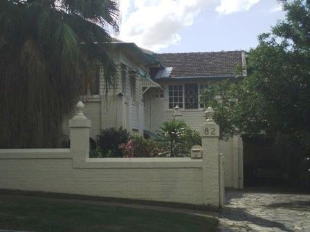
82 Enderley Rd, Clayfield (1 123m²)
• Highset timber interwar house with terracotta tiled roof
• Built circa 1927 for Mr and Mrs James Ernest Stewart (“warehouseman”) at an estimated cost of £2 200.
• Property includes Linstarfield wall entered on LHPO Jan 2005
• PLACE WHICH IS INTEGRAL TO HERITAGE PRECINCT
92 Alexandra Rd, Clayfield (809 m²)
• Lowset timber interwar bungalow with terracotta tiled roof.
• Built 1927 by P Gridley, owner/builder, and sold to Robert Conochie, occupation “agent” in Sept 1927.
• Contains part of former Linstarfield wall – entered on LHPO Jan 2005
• PLACE WHICH IS INTEGRAL TO HERITAGE PRECINCT
94 Alexandra Rd, Ascot (614 m²)
• Highset timber gabled Interwar house with masonry/stucco piers and terracotta tiled roof
• Built circa 1929 for Donald Harris (occupation – “clerk”, “director”)
• Contains part of former Linstarfield wall – entered on LHPO Jan 2005
• PLACE WHICH IS INTEGRAL TO HERITAGE PRECINCT
98 Alexandra Rd, Ascot (635 m²)
• Highset timber triple gabled Interwar house with terracotta tiled roof and masonry/stucco piers
• Built circa 1928 for Henry Chapman, merchant/draper (and relative of James Chapman, resident of 14 Enderley Rd).
• Contains part of former Linstarfield wall – entered on LHPO Jan 2005
• PLACE WHICH IS INTEGRAL TO HERITAGE PRECINCT
102 Alexandra Rd, Ascot (1 528 m²)
• Brick and terracotta tile Interwar bungalow, deep roof.
• Built circa 1926 for William Tudor, a bookmaker, at the considerable estimated sum of £2 500.
• Still on original 1925 block of almost 60 perches (1258 m²) – purchased by William Tudor.
• Has retained tennis court behind house that appears on 1933 detail plan.
• Contains part of former Linstarfield wall – (ends here) – entered on LHPO Jan 2995
• PLACE WHICH IS INTEGRAL TO HERITAGE PRECINCT
Statement of significance
Relevant assessment criteria
This is a place of local heritage significance and meets one or more of the local heritage criteria under the Heritage planning scheme policy of the Brisbane City Plan 2014. It is significant because:
Supporting images
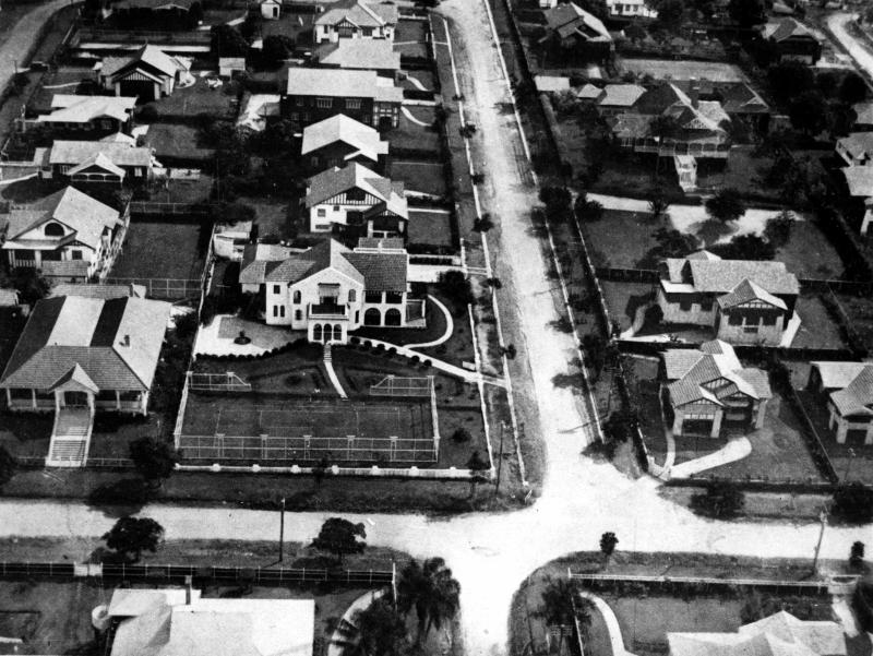
The Queenslander (Brisbane, Qld. : 1866-1939),
‘Aerial view of houses in Clayfield, Brisbane, 1930’,
John Oxley Library, State Library of Queensland
A modern section of Clayfield. Enderley Road looking across Alexandra Road. In the centre foreground is the residence of Mr H. Drew, with that of Mr A. Midson adjoining on the left. (Description supplied with photograph)
Breffney-Stirling, 83 Enderley Rd, Clayfield, (2 428m²)
Bilboa, 77 Enderley Rd, Clayfield (809m²)
Girrawheen, 71 Enderley Rd, Clayfield (809m²)
67 Enderley Rd, Clayfield (1214 m²)
102 Alexandra Rd, Ascot (1 528 m²)
63 Enderley Rd, Clayfield (809m²)
Fetlar, 57 Enderley Rd, Clayfield (1214 m²)
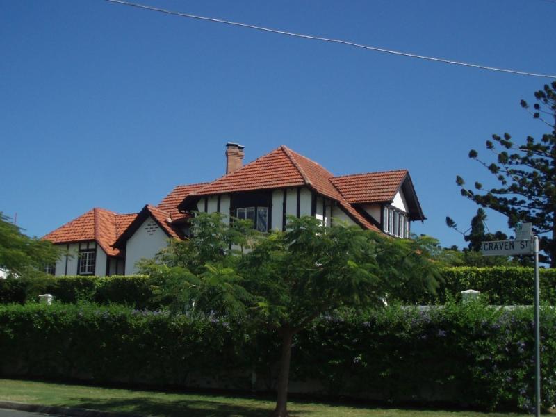
Delcotta, 19 Craven St, (was 51 Enderley Rd) (1645 m²)
Camara, 24 Enderley Rd, Clayfield (8033m²) and adjoining vacant lot 26 Enderley Rd (401m²)
32 Enderley Rd, Clayfield (2 238m²)
Ralahyne, 40 Enderley Rd, Clayfield (3 331m²)
52 Enderley Rd, Clayfield (1 277 m²)
Lynton, 58 Enderley Rd, Clayfield (835 m²)
60 Enderley Rd, Clayfield (794 m²)
Linstarfield , 64 Enderley Rd, Clayfield (3 101m²)
72 Enderley Rd, Clayfield (1 123 m²)
82 Enderley Rd, Clayfield (1 123m²)
92 Alexandra Rd, Clayfield (809 m²)
94 Alexandra Rd, Ascot (614 m²)
98 Alexandra Rd, Ascot (635 m²)
References
-
FB Charlton, Clayfield as I have seen it. In Charlton and Nolan, Stockbroking with the Charltons (Brisbane: JF Charlton, 2002), p. 89
-
Architectural and Building Journal of Queensland, Brisbane , 1922-1940
-
Brisbane City Council aerial photographs
-
Brisbane City Council Detail Plans
-
BCC Building Registers
-
Brisbane City Council Building Cards
-
Charlton, John and Carolyn Nolan. Stockbroking With the Charltons. Brisbane: JF Charlton, 2002
-
Certificates of Title, Department of Natural Resources and Water
-
John Oxley Library, photographic collection.
-
Kennedy, Michael Owen. Domestic Architecture in Queensland Between the Wars. Unpub Thesis. Master of Built Environment. 1989
-
McKellar's Map of Brisbane and Suburbs. Brisbane: Surveyor-General’s Office, 1895
-
Queensland Electoral Rolls
-
Queensland Post Office Directories, 1868-1949
-
Queenslander, 1927.
-
Truth, 1930
Citation prepared by — Brisbane City Council (page revised August 2024)