Addresses
Type of place
Dam / reservoir
Period
Victorian 1860-1890

This is an image of the local heritage place known as Gold Creek Reservoir
Gold Creek Reservoir
Addresses
Type of place
Dam / reservoir
Period
Victorian 1860-1890
The Gold Creek Reservoir was created in response to concerns about the Enoggera Reservoir’s ability to provide sufficient water for Brisbane residents. Work commenced in 1882 and on completion in 1885, the reservoir was fourteenth largest dam in Australia, with facilities spread across 80 hectares. The reservoir continued to provide water in conjunction with Brisbane’s other dams until it was decommissioned in 1991. The four predominant features to the Reservoir are the embankment or dam wall, the spillway, the outlet and ancillary structures, including a timber caretaker’s house. Other striking features of the site are the concrete outlet tower, dramatically overscaled steps of the spillway and the meter house, as well as the serene backdrop of the man-made lake and surrounding bush.
Lot plan
L235_S31395; L281_SP259807
Key dates
Local Heritage Place Since —
Date of Citation —
People/associations
Alexander Stewart - The meter house (Architect);John Henderson (Engineer)
Criterion for listing
(A) Historical; (B) Rarity; (D) Representative; (E) Aesthetic; (H) Historical associationInteractive mapping
History
In 1879 Brisbane’s sole source of reticulated water was the Enoggera Reservoir, situated some twelve kilometres west of the city. Concerns about Enoggera’s capacity to service Brisbane’s daily peak demand and its long term water supply needs prompted the Brisbane Board of Waterworks to investigate means of improving supply. The Board’s clerk of works, Charles Sigley, prepared a report accordingly and a copy was forwarded to the Colonial Secretary. The Colonial Government responded by posting engineer John Henderson to Brisbane in 1879 to address the problem.
Henderson endorsed the Gold Creek location that had previously been suggested by Sigley and the Board’s Surveyor, A.C. Gregory. Gold Creek Reservoir would be situated at a greater height than Enoggera and would deliver water to Brisbane via a separate main. Site works commenced in 1882 and tenders for the construction of the dam were let in June 1883. The construction period was marked by tensions between the Board and the Government over delays and increasing costs. (The Government had funded the project via loans). The installation was eventually handed over to the Board on 10 April 1886. At the time of its completion, Gold Creek dam was the fourteenth largest dam constructed in Australia and the second source of Brisbane’s reticulated water. Subsequent episodes of drought and flood tested the dam and ongoing modifications were made to pipelines and the bye-wash, including the construction in 1890 of the distinctive stepped concrete channel, which diverted overflowing water into Gold Creek. There were also problems with the potabilty of the water, the stability of the dam wall and in 1904, the collapse of the cast iron outlet tower. Early in 1906 problems with the wall were finally corrected and the tower replaced, but in subsequent years the quality of the water continued to concern the Board.
Plans were made to build treatment works at each source of Brisbane’s supply – Enoggera, Gold Creek and Mount Crosby, which had opened in 1893. The Gold Creek plant was never built and the reservoir was taken out of service in 1919. Eventually a pipeline to the Enoggera Reservoir was constructed so that Gold Creek water could be processed there. Intermittent boggy patches on the downstream face of the dam gave cause for concern over the ensuing decades and after the 1974 Brisbane flood the spillway weir was lowered to reduce pressure on the structure. The pipeline to Enoggera was decommissioned in 1977, recommissioned in 1986 and finally decommissioned in 1991. The Gold Creek Reservoir is now used only to supply untreated water to some properties in the upper reaches of Gold Creek.
In 2005 minimal works were taken to repair and stabilise some of the significant components of the site.
Description
There are four main parts to the Reservoir – the embankment or dam wall, the spillway, the outlet and ancillary structures.
The function of the Gold Creek facility is the storage and distribution of untreated water. The stored water is withdrawn through openings in the outlet tower. A 36” wrought iron pipe takes the water from the base of the tower, then on a curved path beneath the embankment to a meter house. From there the pipework diverges – with a branch serving nearby properties and a redundant branch to the Enoggera Reservoir.
The embankment is 187 metres long, 25.8 metres high and 6 metres wide at the crest. It was designed by J.B. Henderson and constructed between 1882 and 1885. It is built in five vertical layers, the centre one being the wall of puddle clay that provides the water seal. The puddle wall is sandwiched between inner shoulders of unknown material, which are in turn enclosed in outer shoulders composed largely of clay. The upstream face was originally clad in ‘heavy metal’ from the base to within 0.3m of the high-water level and above in concrete block. However the metal was replaced with material of unknown specification. The blocks are an interesting feature of the dam and add to the cultural heritage significance. The crest of the dam is approximately 6m wide and incorporates a vehicular drive. The upstream and downstream faces of the dam wall are overgrown with weeds.
The spillway (or byewash as it was traditionally termed) is located at the northern end of the dam. The weir is some 54 metres wide and leads into a channel consisting of a flight of twelve concrete septs 4.2 metres wide and 1.5 metres in height. The weir was lowered by 1.2 metres in 1976 by removing most of the top step and protecting the exposed walls with concrete buttresses. At the foot of the flight of steps the channel takes a sharp turn to the south and has cut a channel running for some 250 metres almost parallel to the dam before joining the bed of the original Gold Creek. It is crossed by a concrete footbridge some 100 metres below the flight of concrete steps. The bridge has a steel pipe balustrade and was built in 1975.
The water delivery outlet is at the northern end of the dam and consists of a cylindrical concrete tower containing the water intakes and valving. It is connected at its base to a wrought iron pipe 36 inches in diameter, which is laid along a curved tunnel and delivers water to a cast iron Y piece at the entrance to a meter house. The iron pipe then continues to an open outlet overlooking the spillway channel and adjacent to the toilet block. The delivery main crosses the spillway channel immediately downstream of the bridge and leaves the site adjacent to the main gate.
The meter house is a simple, gable-ended red brick building with corrugated iron roof and timber double doors on the east side. Some of the original roofing has been replaced with clear corrugated plastic to improve light conditions in the meter house. It was designed by Alexander Stewart and built from bricks surplus to the requirements of the dam constructors after the water meters and pipework had been put in place. The meter house still contains original pipework and equipment.
Ancilliary items include a timber caretaker’s house. It is supported on timber and concrete stumps, has a corrugated iron hipped roof and has verandahs on three sides. It appears to have undergone modifications, and does not appear to be the ‘reservoir keeper’s house’ designed by Henderson for the site. Nor does it appear to be the house designed for the engineer and bearing the signature of Thomas Curry.
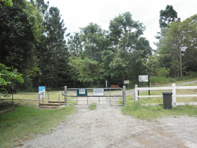
Other ancillary items are the site water supply, the modern brick toilet block, an outdoor fire place and flue, a meteorological station and the main gate to the site. A white post and rail timber fence bars access to the site.
Statement of significance
Relevant assessment criteria
This is a place of local heritage significance and meets one or more of the local heritage criteria under the Heritage planning scheme policy of the Brisbane City Plan 2014. It is significant because:
References
-
Conservation Management Plan Site Plan June 2001
Citation prepared by — Brisbane City Council (page revised September 2020)