Addresses
Type of place
Natural feature, Reserve
Period
Late 20th Century 1960-1999
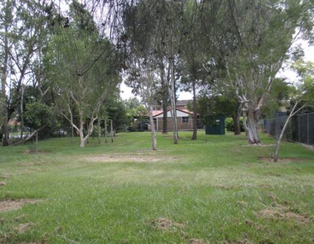

This is an image of the local heritage place known as Brisbane Mud Springs Park
Brisbane Mud Springs Park
Addresses
Type of place
Natural feature, Reserve
Period
Late 20th Century 1960-1999
The mud springs are a unique geological feature, being possibly one of only two such formations in Australia. From 1865, the mud springs were part of a farm. In 1970, Brisbane City Council works disturbed the site resulting in an eruption of hot mud and stinking hydrogen sulphide gas. A concrete cap was placed over the mud springs to stop the flow and the site fenced for public safety. In 1979, the site became a park.
Also known as
Aspley Mud Mounds
Lot plan
L10_RP160292
Key dates
Local Heritage Place Since —
Date of Citation —
People/associations
Brisbane City Council (Association)Criterion for listing
(A) Historical; (B) Rarity; (C) ScientificInteractive mapping
Also known as
Aspley Mud Mounds
Lot plan
L10_RP160292
Key dates
Local Heritage Place Since —
Date of Citation —
People/associations
Brisbane City Council (Association)Criterion for listing
(A) Historical; (B) Rarity; (C) ScientificInteractive mapping
History
This property contains a rare geological formation, hot mud springs, of which there is possibly only one other similar site in Australia. The mud springs have a subterranean depth of 30 metres and comprise a dome of methane gas under a clay cap. They are connected by an underground stream to a sub artesian basin that runs as far as Bald Hills. Originally the mud springs had two outlets, with one at the present location of this park and the other being further east near what is the section of Gympie Road that is north of Cabbage Tree Creek. The area containing these two mud springs would have been known to the Undanbi people and may have had some spiritual significance for them.
The first land sales for the Aspley district were held in Sydney in February 1857. On 27 September 1860, John, Henry and Samuel Raynbird purchased Portions 22 and 26 (Parish of Nundah), situated between Cabbage Tree Creek and Graham Road. The site containing the mud springs that was on the other side of Graham Road, was part of a further purchase of land made by the Raynbird brothers of Brisbane, on 26 April 1865. They bought Portion 152 in the Parish of Nundah, comprising 24 acres and 1 rood of uncleared land, for ₤24 and 5 shillings. After John Raynbird died on 10 April 1870, his share of Portion 152 passed to his eldest son and heir, Harry Raynbird. Upon Henry Raynbird’s death in 5 November 1878, his share of Portion 152 was transferred to his widow, Margaret.
Margaret Raynbird married Peder Knudsen on 14 June 1881 and Samuel Raynbird and his nephew Harry decided to subdivide Portion 152 into two allotments. Consequently Margaret Knudsen was given the title deed to Subdivision 1 of Portion 152 on 27 April 1886. She had gained the larger of the two subdivisions, with her share covering 16 acres, 2 roods and 4 perches of land that included the mud springs.
On 14 October 1911, the title to Subdivision 1 of Portion 152 was transferred to Carl Friedrich Wilhelm Pietsch. Pietsch already owned a small block of just 3.5 acres along Graham Road, which he had bought when that part of Aspley was subdivided into small farms during the 1890s. Pietsch worked in the bacon curing section of the Huttons Factory at Zillmere but with his large purchase of land he branched out into small crops, especially pineapple farming. He even tried his hand at canning. With Richard Sumner, Pietsch hand soldered tins of his Ripley Queen pineapples, which they forwarded to Sydney where the shipment was promptly condemned. Possibly as a result of this disastrous business experiment, Pietsch sold off 6 acres of the latter land purchase to Pietrs Previtera on 24 August 1928.
During the 1920s, when the Queensland Public Works Department was strengthening Gympie Road, it filled in the Gympie Road mud springs with boulders and other rubble. As a result, the mud springs on Pietsch’s farm became more active, with mud erupting into the craters on the site. The mud springs then began to attract more attention from locals and the occasional visitor to Aspley.
Carl Pietsch died on 31 May 1934 and his estate, including the 10 acres, 2 roods and 4 perches of Resubdivision 2 of Subdivision 1 of Portion 152, passed to his son William James Pietsch. By this time, Hawbridge Street had been formed and it marked one side of the boundary of the Pietsch farm. The Great Depression affected the farmers of Aspley as it did the rest of Australia, and William Pietsch was forced to mortgage his land in 1935 and again in 1936. Finally Pietsch sold out to husband and wife Rosario and Maria Marano Spina on 29 July 1936. Rosario Spina continued to farm the land until his death on 13 June 1946. That same year the mud springs became very active, spewing forth mud that formed five mounds standing 3 metres high. Spina’s widow, Maria held onto the property until 1974, though she had a small parcel resumed for the purposes of a dedicated road in 1973.
Because of its unique geological activity, the mud mounds site was selected in 1970 for a test bore to be drilled in the search for natural gas. The bore was sunk to a depth of 360 metres and testing gave indications that there were substantial reserves of methane gas underground to a depth of 1,300 metres. Also in 1970, the Brisbane City Council began laying a large water main across Graham Road, to service the planned residential redevelopment of farmland in the area. In the process, the Council demolished the mud mounds and this led to a large amount of hot mud pouring out of the resultant hole in the ground. It moved in two streams “like a giant toothpaste tube” across Hawbridge Street thereby blocking access. As well, hydrogen sulphide gas began to escape into the atmosphere causing a terrible stench to permeate the surrounding area. Hawbridge Street had to be closed for eight weeks, as Council trucks removed the mud from the site, causing the ground to sink. In the end, the Council resorted to dumping sheet pilings onto the mud to form a caisson for its water pipes plus twelve truckloads of cement were poured over the pipes to secure them in place. At the completion of this work, the earth crust covering the mud springs was only 15 centimetres thick. So, as a safety precaution, the mud springs site was enclosed by a high fence, with warning signs erected, advising the public to keep off the area.
On 12 February 1974, T.C. Comino & Co Pty Ltd purchased the property, which had been given the designation Lot 2 on RP 143250. By this time, Brisbane’s urban sprawl had spread through West Chermside and Aspley and was leading to housing estates being created in the new suburb of Carseldine. In 1976, T.C. Comino & Co. subdivided this land into three suburban allotments and one large block that held the mud springs. More and more of this block was subdivided for housing development during 1976-1979, with the site of the mud mounds being the only unsaleable land in the area. So on 8 February 1979, the Brisbane City Council took control of the site for the purposes of using it for parkland.
Description
The Brisbane Mud Springs Park is located at the intersection of Hawbridge Street and Graham Road. The site is predominantly parkland enclosed by a high fence for public protection from further mud spring activity.
The artificial bore, sealed with a metal cap over a concrete base, is currently located within the enclosed area of the site and is surrounded by mature gum trees and several other smaller shrubs scattered loosely throughout the site.
Along the area of the site where the ground sinks inwards, short timber stumps protruding from the ground suggest a previous structure, possibly a walkway. An existing shade structure of square timber columns supporting a skillion roof and with a concrete ground slab currently sits unused on site.
The shade and screening provided by the trees greatly enhance the character of the adjacent residential properties and provide significant relief visually to the intersecting roads.
Statement of significance
Relevant assessment criteria
This is a place of local heritage significance and meets one or more of the local heritage criteria under the Heritage planning scheme policy of the Brisbane City Plan 2014. It is significant because:
References
-
Brisbane City Council, Properties on the Web, website
-
Brisbane City Council Parks North, notes on Brisbane Mud Springs
-
Brisbane City Council, 1946 aerial photographs.
-
Brisbane City Council’s Central Library, Local History file – Zillmere – Geebung – Aspley – Bald Hills
-
Department of Natural Resources, Queensland Certificates of Title and other records
-
John Oxley Library, Parish of Nundah, County of Stanley, L.A.D. of Brisbane map, (1899 land grant map).
Citation prepared by — Brisbane City Council (page revised September 2020)