Addresses
Type of place
Retaining wall
Period
World War II 1939-1945
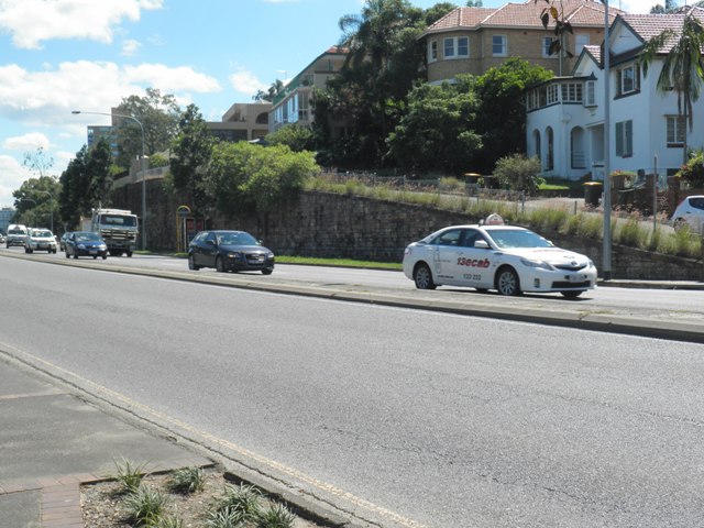

This is an image of the local heritage place known as Hamilton retaining wall No. 1
Hamilton retaining wall No. 1
Addresses
Type of place
Retaining wall
Period
World War II 1939-1945
Hamilton Retaining Wall No.1 is a fine example of mid-twentieth century stone retaining wall construction. This wall, and its counterpart further along Kingsford Smith Drive, is a prominent landmark in the district, the scale, texture and colour of the walls having considerable visual impact on Kingsford Smith Drive and the associated riverscape.
Geolocation
-27.439704 153.061247
Key dates
Local Heritage Place Since —
Date of Citation —
Construction
Walls: StoneCriterion for listing
(A) Historical; (B) Rarity; (E) AestheticInteractive mapping
Geolocation
-27.439704 153.061247
Key dates
Local Heritage Place Since —
Date of Citation —
Construction
Walls: StoneCriterion for listing
(A) Historical; (B) Rarity; (E) AestheticInteractive mapping
History
The suburb of Hamilton is a residential area important for its elevated sites offering dramatic views of the river and areas beyond and taking advantage of the sea breezes. The value of the Breakfast Creek/Hamilton district had been recognised from the earliest settlement of Brisbane. In 1824, prior to the resiting of the Moreton Bay penal colony from Redcliffe to Brisbane, Breakfast Creek was nominated by Governor Brisbane and John Oxley as a more suitable place for settlement.
The first known settlement in the area was the establishment of Eagle Farm in 1829. During 1829-30 the present main thoroughfare, Hamilton Road (now known as Kingsford Smith Drive), was hewn from rock along the riverside and linked the convict women’s goal at Eagle Farm with the city settlement.
Land in the area was cleared by convicts and by the 1840s wealthy free settlers were attracted to the area by the elevated hilly country which offered river views and sea breezes. However, rough and swampy roads deterred settlement generally and residential development in the area was slow. In 1899 the tram line was extended from Breakfast Creek to Ascot and heralded an influx of settlers.
The wall was initially a raw rock embankment remaining along Hamilton Road after the road was cut through. As part of attempts to widen Hamilton Road in the 1930s, a Brisbane Tuff retaining wall was constructed by 1946 to support the embankment, as residences had been established on land immediately above the embankment.
Description
There are two substantial quarry-faced Brisbane Tuff retaining walls along Kingsford Smith Drive, Hamilton. The scale, textured surface and the distinctive pinks, greens and browns of the Brisbane Tuff contribute to the visual impact along Kingsford Smith Drive. Individual stones are cut in irregular sizes and blocks are laid in courses. The wall between Riverside Terrace and Quarry Street has a quarry-faced Brisbane Tuff capping and the wall extending east from Crescent Road has a concrete and dressed stone capping.
Riverside Terrace to Quarry Street Retaining Wall
A quarry-faced Brisbane Tuff retaining wall extends approximately 120 metres along Kingsford Smith Drive between Riverside Terrace and Quarry Street ranging in height from 0.5 metres to 6 metres. For approximately forty metres the wall supports a vehicular tarmac road ramping up from Riverside Terrace providing access to five properties overlooking Kingsford Smith Drive. The retaining wall continues at this height to the property on the corner of Quarry Street and Kingsford Smith Drive where the wall separates into two parts. The upper wall terminates at the south entrance gate pier of the property and a lower retaining wall terminates at a flight of concrete stairs with an adjacent garden to the upper wall. A portion of the wall near the Quarry Street end is noticeably different in composition containing larger stones to the lower part of the wall. A pedestrian footpath runs along Kingsford Smith Drive at the base of the wall. Creepers are growing over the top of the wall in some parts.
Statement of significance
Relevant assessment criteria
This is a place of local heritage significance and meets one or more of the local heritage criteria under the Heritage planning scheme policy of the Brisbane City Plan 2014. It is significant because:
Citation prepared by — Brisbane City Council (page revised August 2023)